
Bahamas - 700 Magnificent islands to discover!
If a multihull paradise exists, then this is it: the giant, shallow anchorages take on the color of a swimming pool - those with a draft exceeding two meters are asked to sail elsewhere. A multihull friendly destination par excellence!
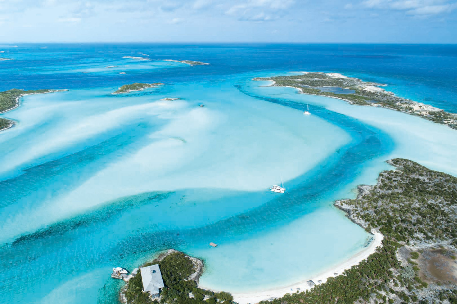
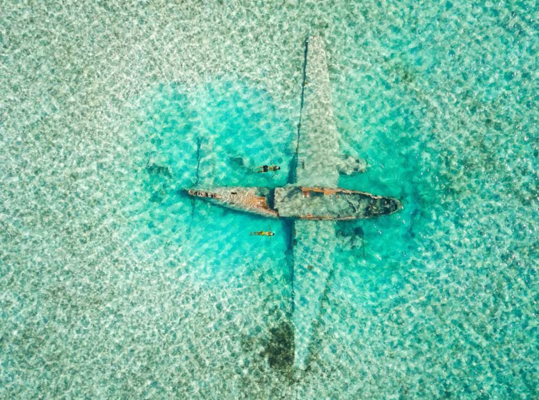
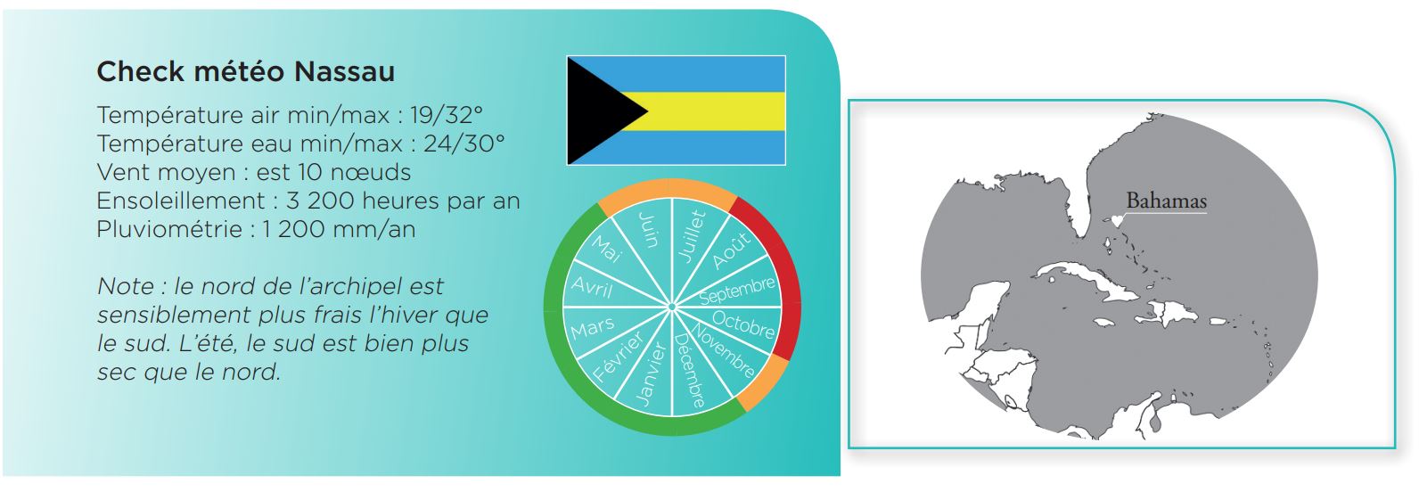
The Bahamas are wedged between southern Florida and northeastern Cuba. There is a huge territory to discover: 100,000 square miles, which is 6,500 square miles more than the United Kingdom! A country with more sea than land, and independent since 1973. Only about twenty islands are inhabited all year round. To the south there is a succession of sandy and coral islets, where there is no chance of getting supplies. To the west, the Bimini Islands are the closest to the American coast (only 40 miles). However, it is a little further east, on the islands of Great Abaco and Nassau, that you will find the main infrastructures. The sailing season extends from December to June; the hurricane season starts in August and continues until November. The Bahamas archipelago is made up of huge lagoons, separated by a few dozen miles. It is during these journeys that one sometimes feels the swell of the open sea or at least the wind over the sea. Other than that, the sailing is all about wandering from one deserted beach to another, in a giant swimming pool. Sailing times can be very short, dives a little less so - which ensures that your days are always busy! The wildest area? The Exumas archipelago, only 26 miles off the southeast coast of Nassau Island. It is home to one of the largest marine parks in the world, the famous «Exuma Cays Land and Sea Park» located in Warderick Wells. Other things to do: stroke the nurse sharks, feed the swimming pigs at Staniel Cay, reveal your inner James Bond in Thunderball’s underwater cave and swim with angel fish, parrotfish and Scissortail Sergeants in the Aquarium. You can even explore the wreckage of the Medellin Cartel’s plane off Norman Cay or play hide-and-seek with the iguanas at Allen’s Cay.
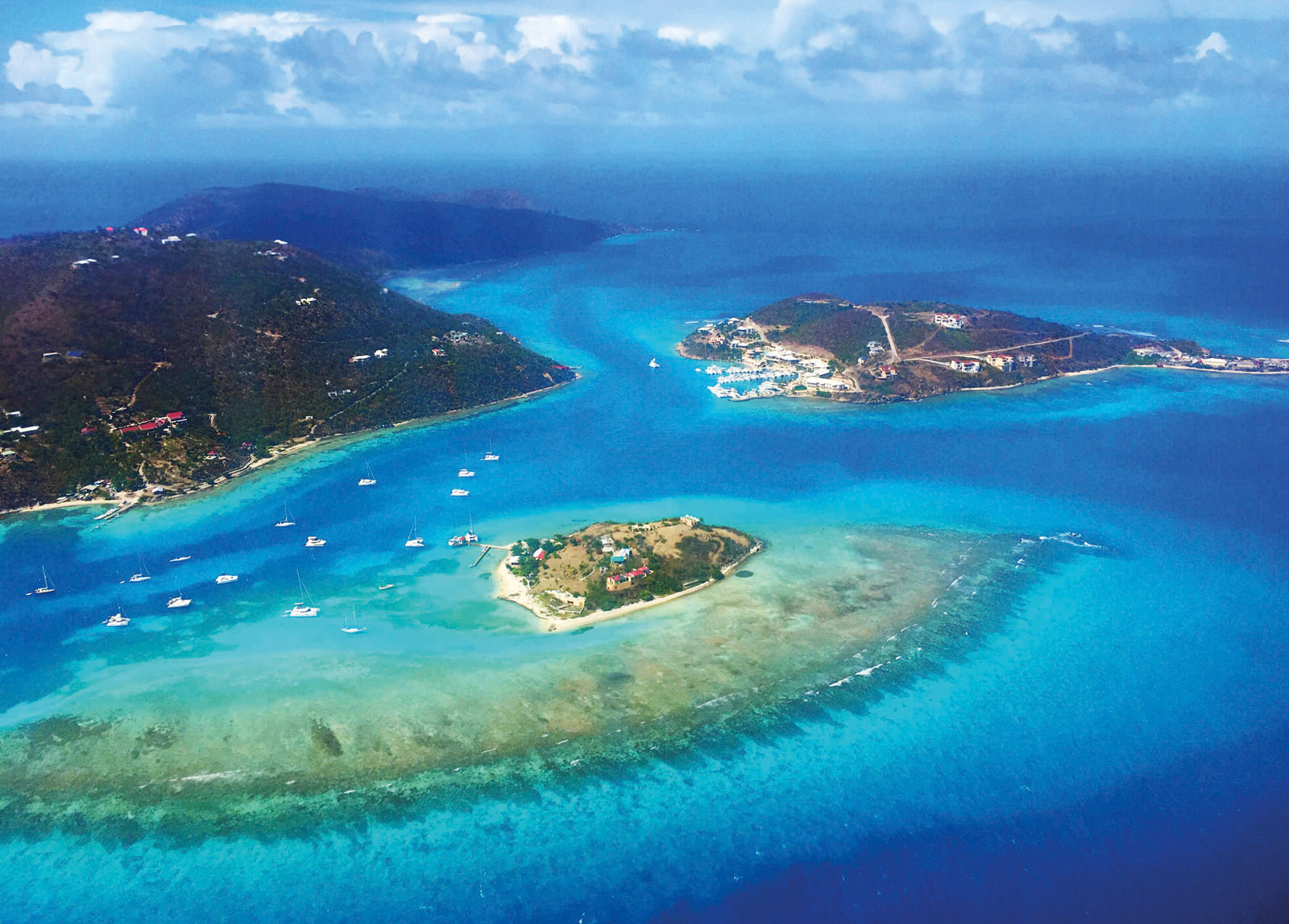
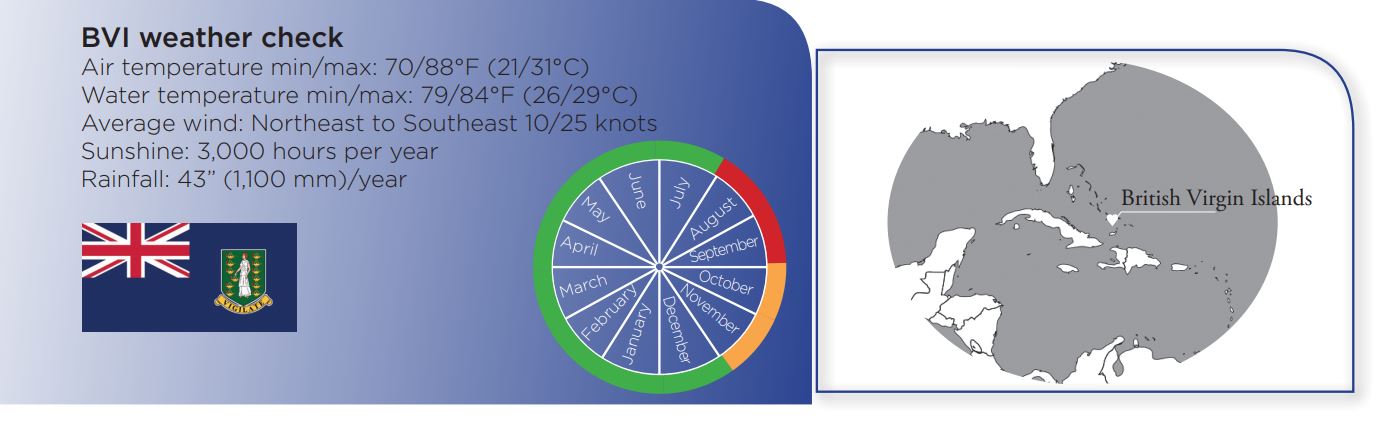
British Virgin Islands - The trade wind of happiness
A variety of islands - some rugged, others flat - pristine sandy beaches, turquoise waters and above all, a constant trade wind: the British Virgin Islands are a true sailing paradise! And the icing on the cake is that there are a few sailors’ haunts where the beer is cold close by the anchorages...
Sailors familiar with the West Indies will already know these idyllic islands. Landlubbers, less so... A bit of geography to start with: the BVI are wedged between Puerto Rico to the west and Saint-Martin to the east. Discovered by Christopher Columbus in 1493, this archipelago of 50 islands - only 16 are inhabited - has had a turbulent history. There were repeated colonizations and piracy, before they were annexed by the British... Today, the BVI is a well-known tax haven (no taxes for companies). These islands are also a tourist destination and a popular sailing area for Americans, although less known to European sailors. From November to May, the easterly trade wind blows at 20 knots or more every day: a paradise for sailing, especially since most of the archipelago is protected from the swell. Not all the islands have leeward anchorages, but the possibilities are endless. Our favorite spots: Guana Island and its nearby White Bay beach, perfect for a first swim in the warm turquoise water; Virgin Gorda and its mythical lagoon; The Baths, an extraordinary tangle of rocks set among lush vegetation; Jost Van Dycke - called Jost or JVD here - and its magnificent beaches. A special mention must go to the flat island of Anegeda, with its bush and coral. Setting Point is a large and popular anchorage. In the evening, the atmosphere is particularly festive at Potter’s Bar, where the crews mark their passage on the beams and walls of the establishment.
 |
 |
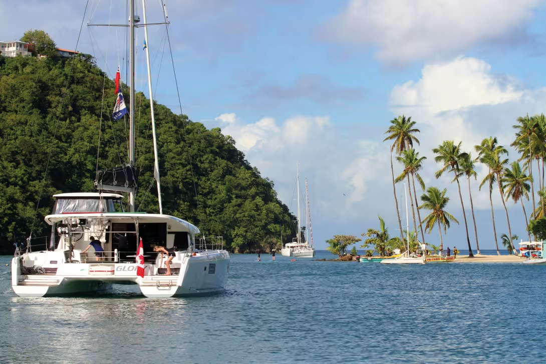
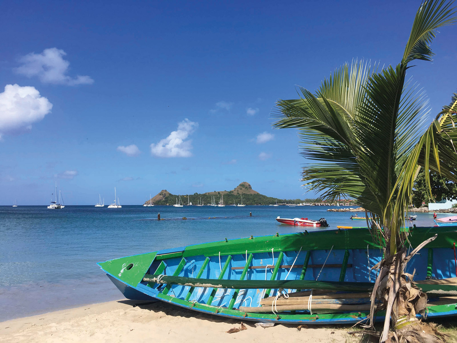
Saint Lucia - The Twin Peak Island
20 miles south of Martinique, Saint Lucia is a perfect stopover on the way to islands further south - Saint Vincent and the Grenadines, Grenada - and finally Venezuela, a safe haven out of reach of the dreaded hurricanes. But the island with the two peaks deserves much more than a simple stopover. .
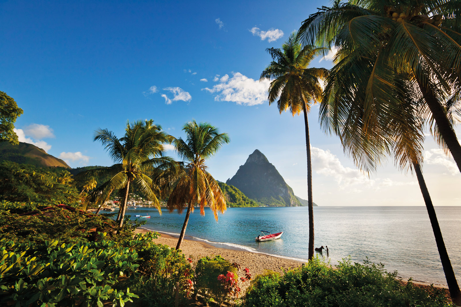
St. Lucia is a volcanic island with rugged terrain which culminates at 3,120 feet (950 meters). There are two spectacular coastal peaks - both of which are close to 2,600 feet (800 meters) high. The windward coast, on the Atlantic side, is pounded by the swell. Some bays are more or less protected by coral reefs, but we do not recommend trying to access these areas. The leeward coast, on the Caribbean Sea side, is much more suitable for sailing. Rodney Bay is the ideal port of call for anything technical. The vast area of water is perfectly protected. There is a large marina, shipyards and various nautical services. South of Castries, the capital, the sandy spit of Marigot Bay and its giant coconut trees are very appealing. Other anchorages worth discovering are Anse Cochon and Anse Chastanet for snorkeling, Soufrière and its numerous huts and wooden houses, without forgetting the still active volcanic site. A short cab ride will take you there, as well as to the Diamond Botanical Gardens and Mamiku Gardens. A final suggestion in this «best of» list? Pitons Bay of course! You will enjoy the sublime anchorage between the two emblematic pitons of St. Lucia, which are connected by a white sand beach lined with coconut trees. We are in the south of the Caribbean arc, but not yet far enough south to escape the hurricanes (August and September). From the end of January to mid-April, the north-east Trade Wind blows steadily. The two intermediate periods (December to early January and mid-April to mid-June) either side of the hottest season when there is little wind are generally subject to the trade winds, but with less strength and regularity. The sea can be rough when leaving the protection of the island.
 |
 |
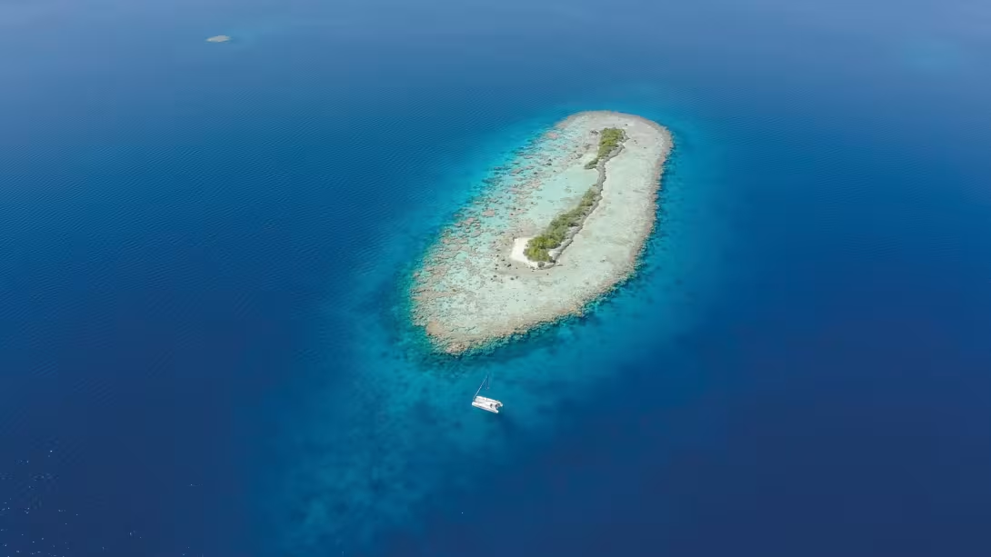
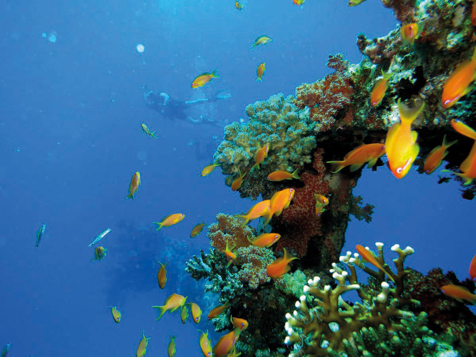
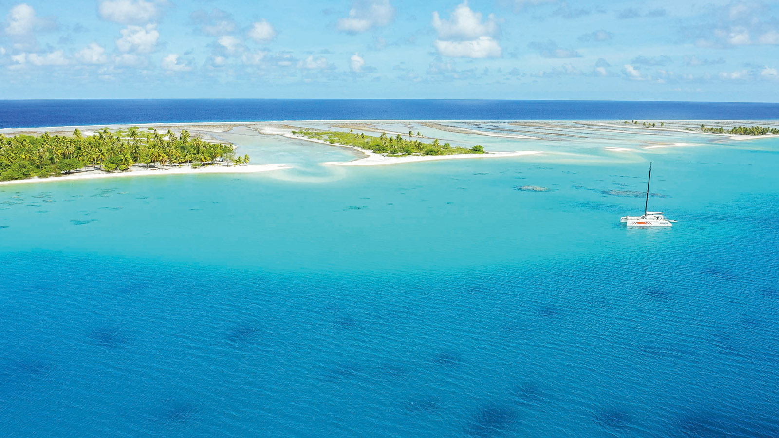
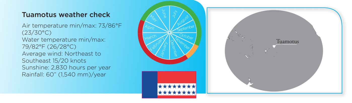
Tuamotus - The kingdom of the atolls
This archipelago in the South Pacific is part of French Polynesia. It is a great favorite with all the round the world sailors. - Rare are those who have not considered staying there... Immaculate white sand, coconut palms and translucent water: what more could you ask for?
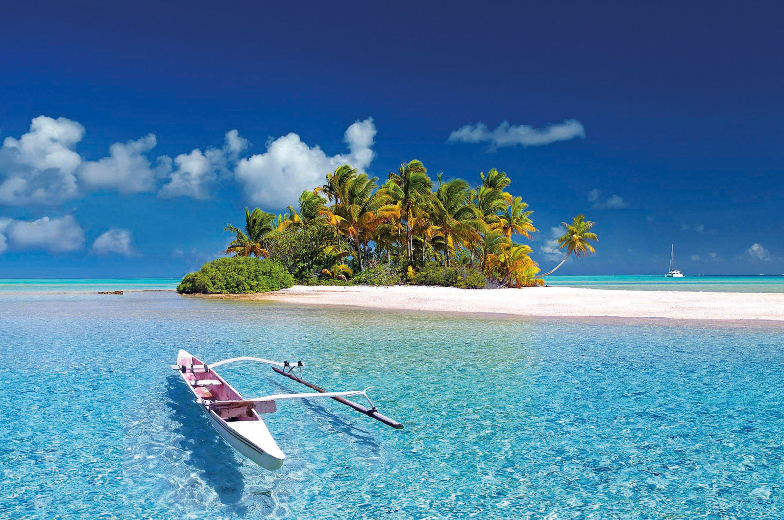
The Tuamotu archipelago has 75 atolls scattered over 5,200 square miles (13,500 km²) of ocean. Tikehau, the closest atoll to Tahiti, is less than 200 miles to the northeast. Each atoll has more or less wide and deep passes. The principle is of course to avoid entering at night but also when there is a strong current and/or swell. Once inside the atolls, you will discover the world of motus, small coral islands that appear out of nowhere, and the countless coral outcrops, which are not necessarily well identified on your charts. This is where satellite images can be useful. Of course, you need to make sure to navigate in these atolls during the day, under a bright sun. All that remains is to find a good place to anchor - sandy bottoms are rare. The relatively flat atolls offer very few sheltered spots. The best places, especially in case of bad weather, are located downwind of the largest motus. Although the sailing can be demanding, it is well adapted to shallow-draft multihulls and the effort is worth it as the sublime environment will reward divers (and fishermen). It is difficult to find any richer and more enchanting underwater landscapes. Just put your head under the transparent water and you will discover thousands of multicolored fish. The best sailing period is during the dry season from May to October. The cyclone season runs from December to April, but sometimes this period remains relatively calm.
 |
 |
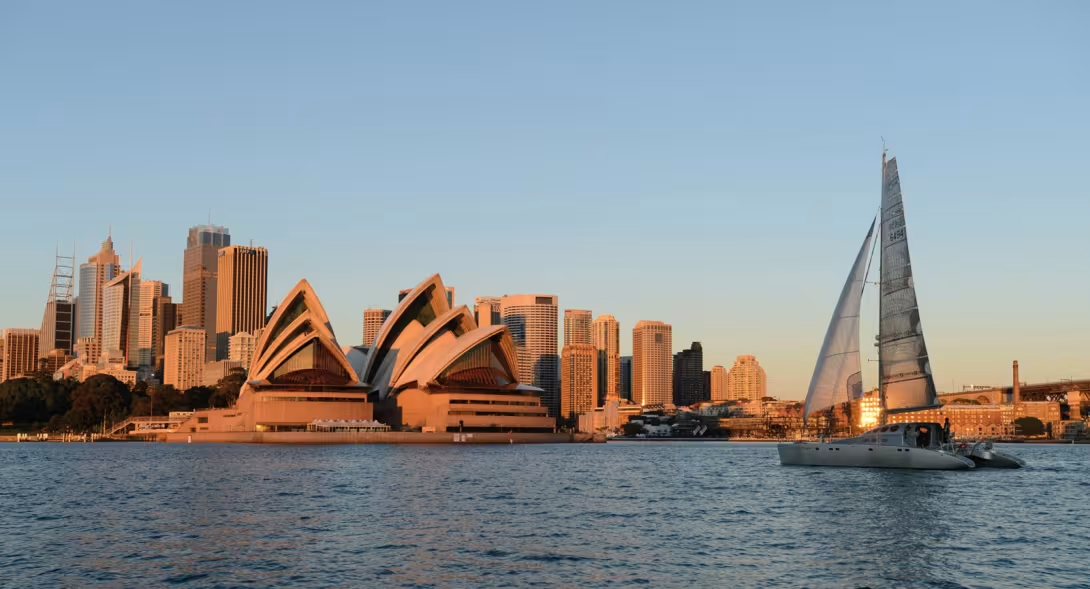
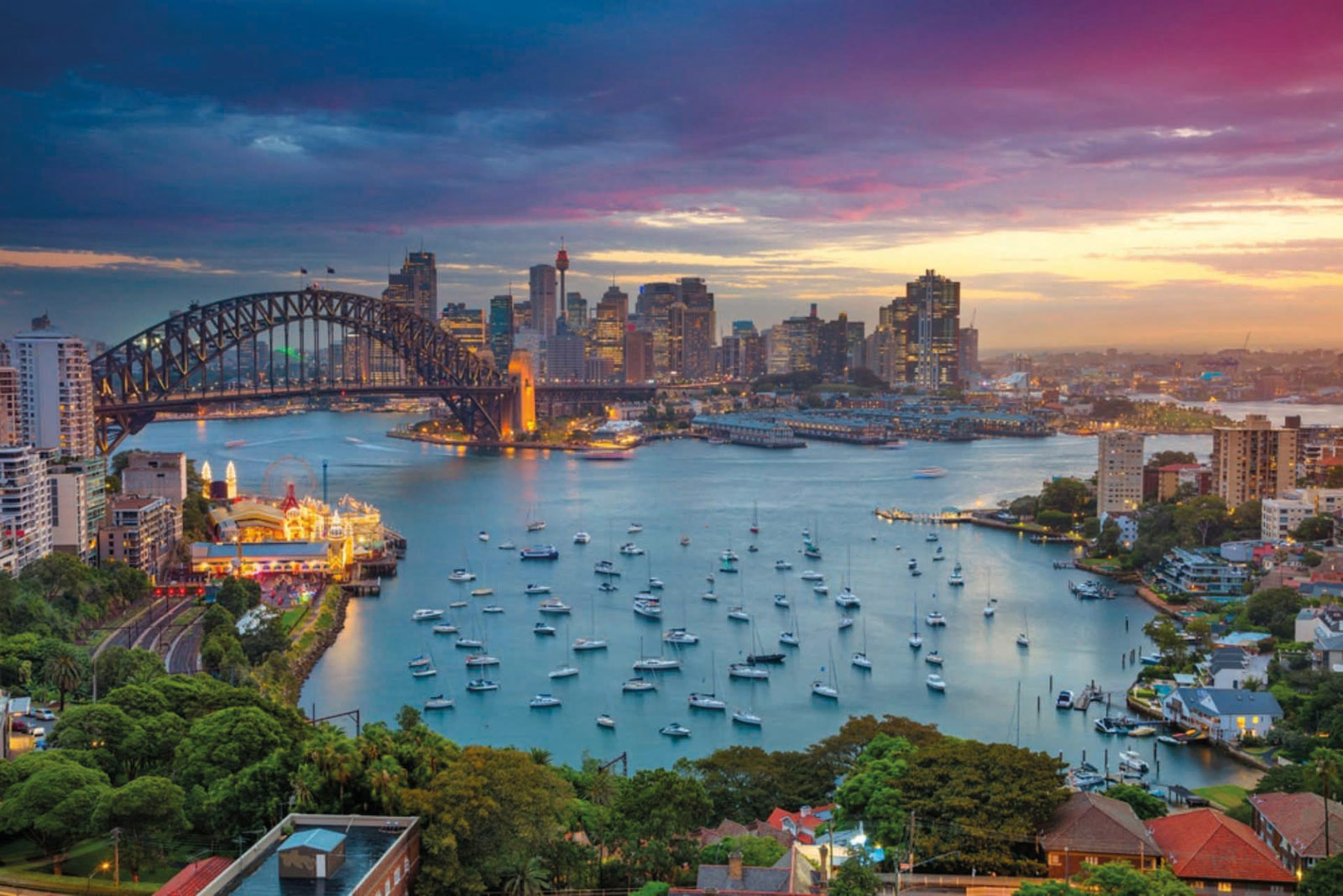
Australia - Departure from Sydney, the sailing capital of the southern hemisphere
For thousands of years, the island continent has been sailing multihulls... first in a proa, and in a catamaran since the 1950s, before taking an interest in the trimaran from 1980 onwards. Such a craze for pleasure sailing and multihulls in particular can be explained simply because Australia is a paradise for long distance cruising. And the center of it all, is Sydney...
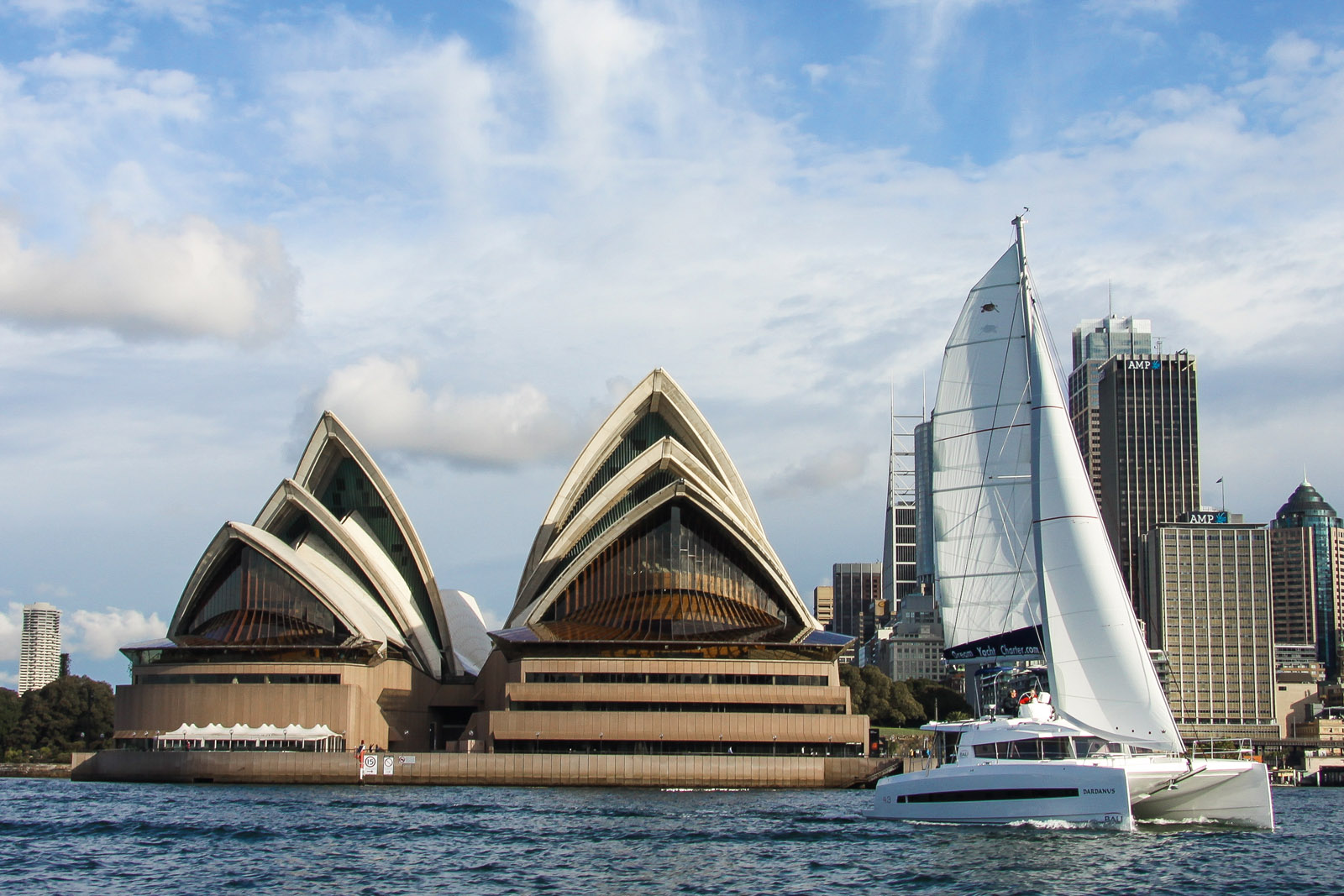
The east coast of Australia is often frequented by Pacific cruisers, who can enjoy the country’s largest city, Sydney, before heading north to continue their world tour. For many sailors, this harbor is one of the best in the world. It provides many sheltered bays and deep water to the shore. Long-term moorings are possible in the heart of the city, in Blackwattle Bay. Anchoring near the beaches in the northern part of the city around Manly is also popular with frequent travelers. There is no shortage of services - boat slips, modern slipways, ship chandlers - and many yacht clubs welcome visitors. The conditions here are so favorable that all local yachtsmen cruise or race all year round. 85% of Australians live along their 15,500 miles (25,000 km) of coastline, mainly in the southeast. And there is one boat for every 24 inhabitants... In Sydney, the evening or weekend regattas are real institutions and the barbecues that close them are essential social events. The bay is an extraordinary playground, but it is easy to extend it infinitely. To the south, there’s no doubt that the conditions on the route to New Zealand can be difficult. On the other hand, towards the north and the Great Barrier Reef, the sailing is easy - but beware of the swell and the sometimes-violent currents.
 |
 |
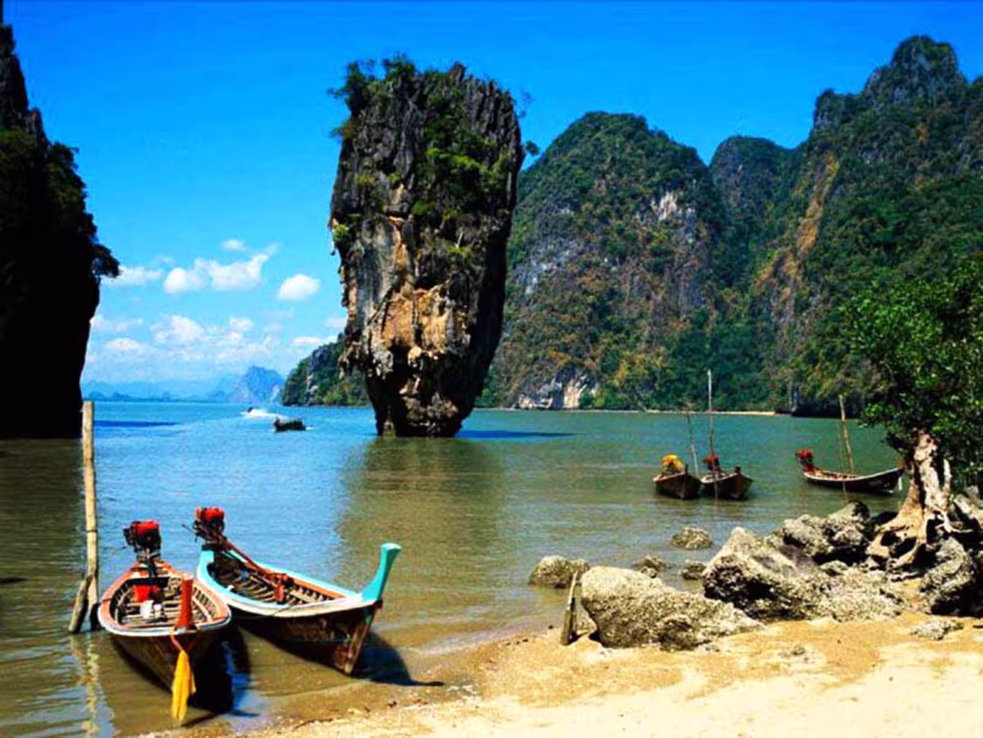
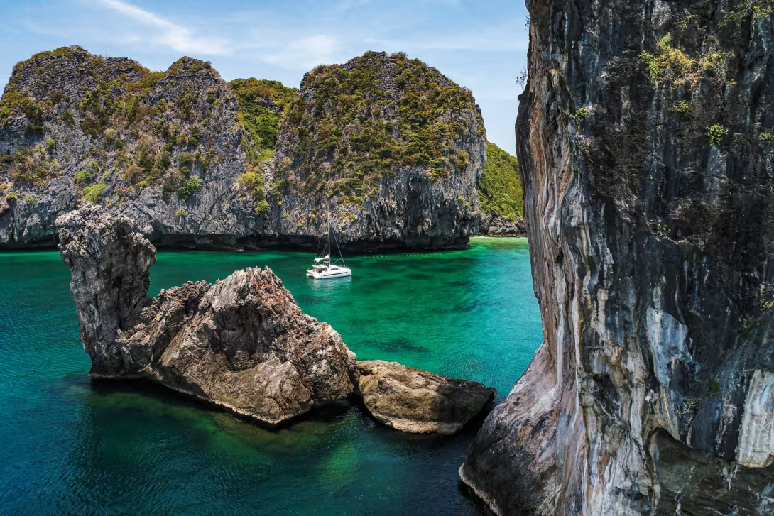
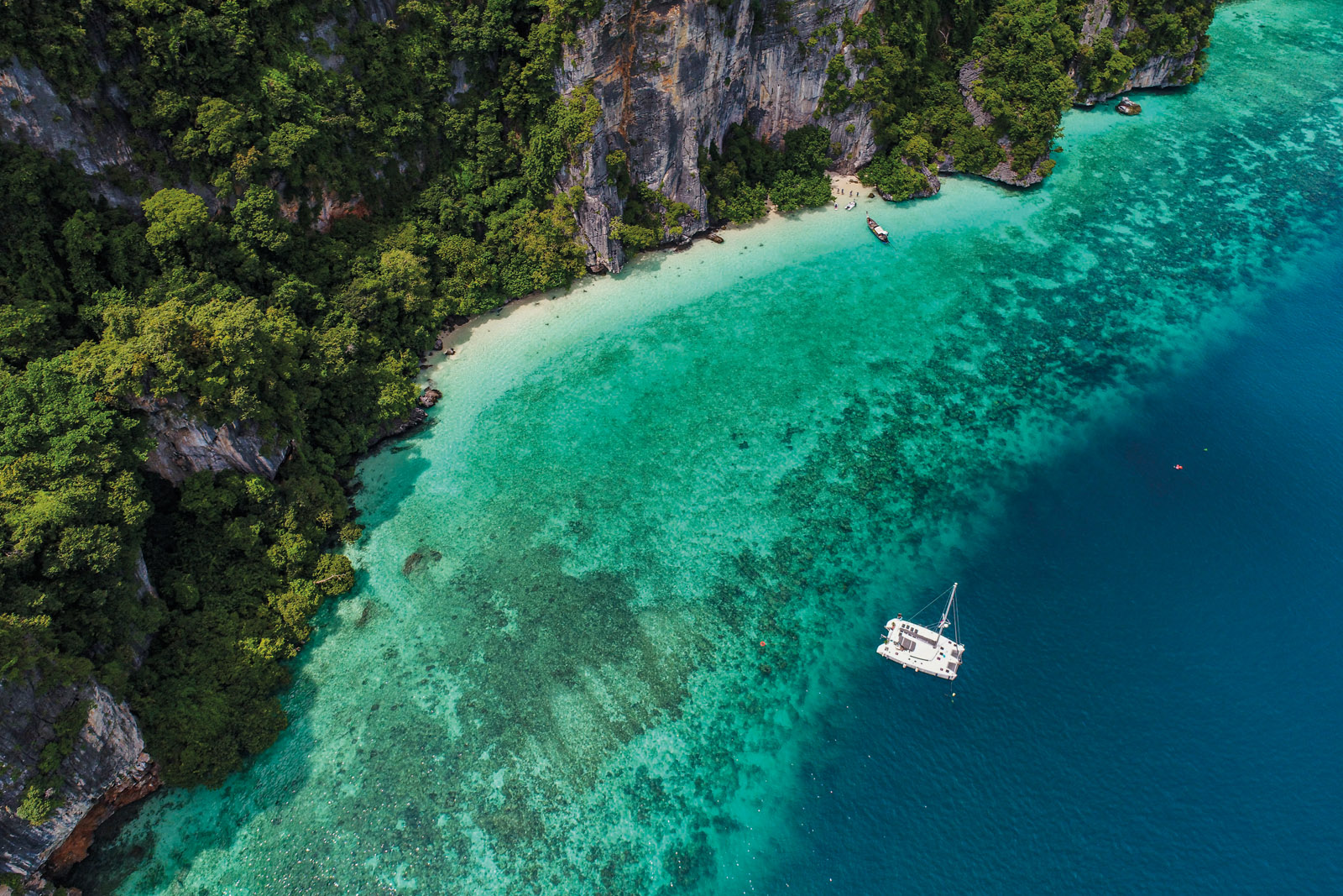
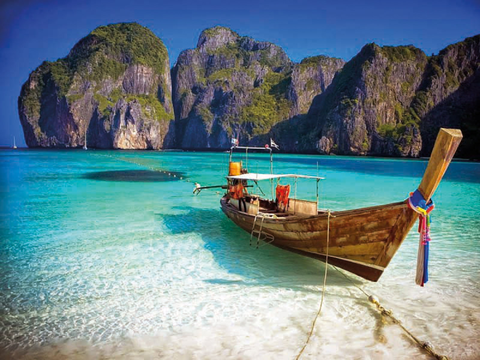
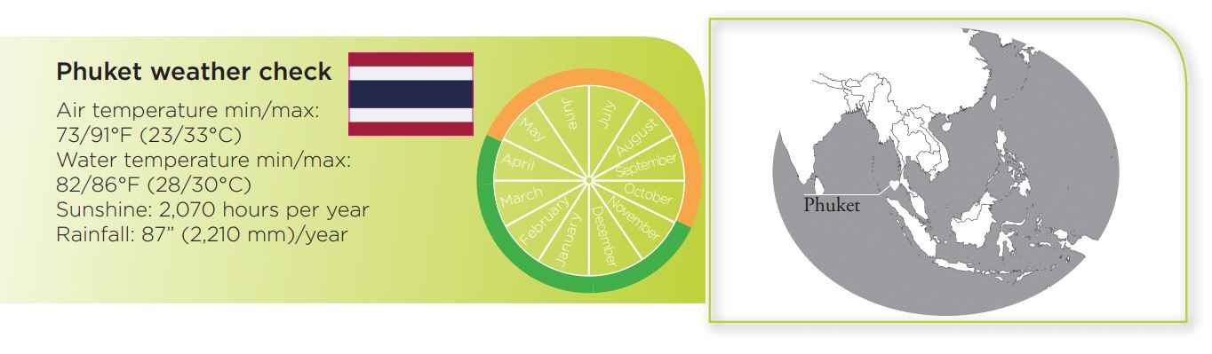
Thailand - The bewitching Andaman Sea
Protected in part to the west by Phuket - the largest island in Thailand, the Andaman Sea reveals landscapes of extraordinary beauty. Rivers, piton islands, lagoons, fishing villages, thick jungle: There’s enough for the most ardent of explorers to discover!
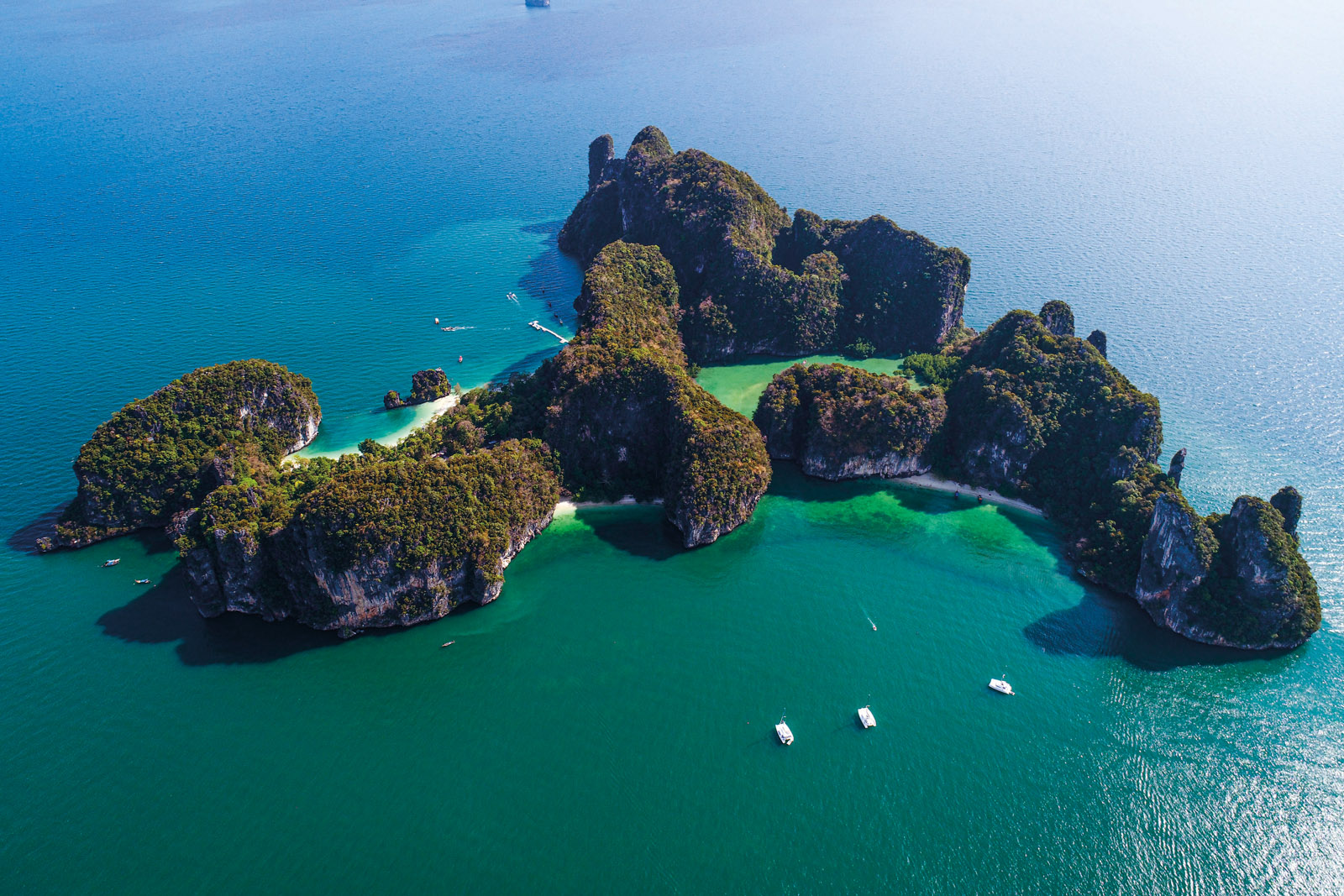
Of course, the destination has been sought-after for several decades by the mass tourism market, but most holidaymakers are concentrated in certain well-defined tourist areas. Once past these few villages, beaches and other attractions, which are inevitably hectic and noisy - but whose atmosphere remains good-natured despite everything else - sailing in the Andaman Sea is full of some incredible surprises. Villages on stilts in the north and along the rivers, piton-shaped islands with secret lagoons and hordes of monkeys, national parks, small fishing ports, deserted beaches, and dive sites in the south. The list of sites and anchorages seems endless! Many boaters have fallen under the spell of the local lifestyle and have stayed... It is hard to resist the beauty of these isolated anchorages bordered by imposing limestone monoliths. We must mention that the Thai people are extremely welcoming, and that the food here is remarkably good - do we really need to showcase the delights of Thai cuisine? There are two seasons on the west coast of Thailand. The first one, from May to October, is the so-called southwest season - it corresponds to the monsoon and therefore results in abundant rain. The second season is the North-East season which runs from March to April and is dry. This is the best time to sail, with an east wind that can reach 20 knots but no swell. During the rainy season, it is not advisable to anchor west of Phuket or in front of any exposed islands. The swell is quite strong and the safest thing to do is to stay in Phang-na Bay, protected from the squalls...
 |
 |
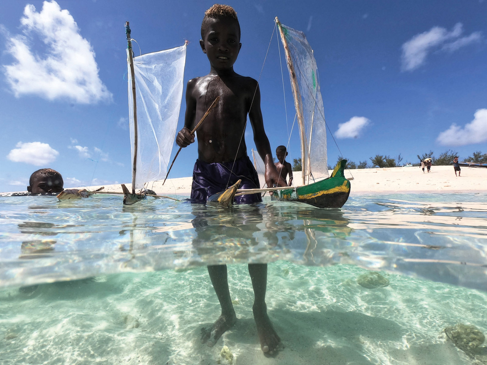
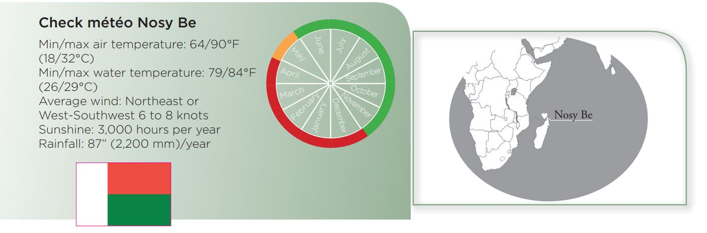
Madagascar - An unsung sailing paradise
Are you tired of big harbor cities, full of noise and pollution? Then set a course for the west of the Indian Ocean and head for Madagascar: there you will find no infrastructure, gorgeous, deserted anchorages, ochre landscapes and coconut palms... a veritable paradise for multihulls!
200 miles off the African continent, Madagascar is a huge island, 980 miles (1,580 km) long from north to south and 310 miles (500 km) wide. It was a piece of Africa that broke away millions of years ago, forming the Mozambique Channel. This island, surrounded by the Indian Ocean, is located between the equator and the Tropic of Capricorn. The first things that you notice are the ochre-colored landscapes and the steep and spectacular terrain - the highest peak reaches 9,436 feet (2,876 m) and the Highlands represent 70% of the territory’s surface area. There is a great variety of landscapes, endemic species and a multicultural population. There is no lack of attractions... But what about the sailing? The channels leading into the numerous lagoons on the east coast are pounded by the ocean swell, while the northwest coast has multiple coves, river mouths and above all a string of islands. It is quite logically on the largest one - Nosy Be - and the one closest to the «Grande Terre» that most blue water cruisers end up spending time. The most favorable months in Nosy Be are May, June, July, August, September and October. January is the rainiest month. The «coolest» months are August and September. The cyclone risk in the area is considered high from November to mid-May. The synoptic wind is generally quite weak - 6 to 8 knots on average and rarely more than 15 knots - from NE or WSW. The relief of the islands and the nearby mountain range in Madagascar block the hot and humid northwest monsoon during the southern summer, and the cooler and drier southeast trade winds the rest of the year. Local breezes allow for pleasant sailing in the afternoons. The water is well protected from the swell - except during tropical storms and cyclones.
 |
 |
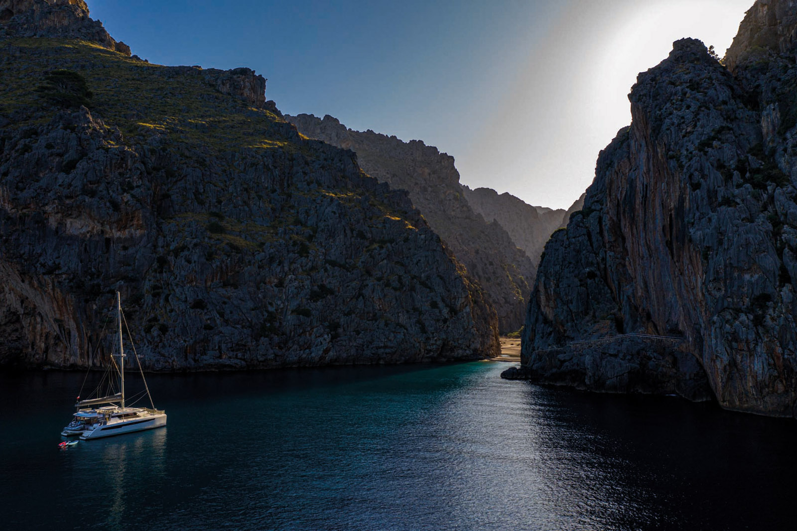
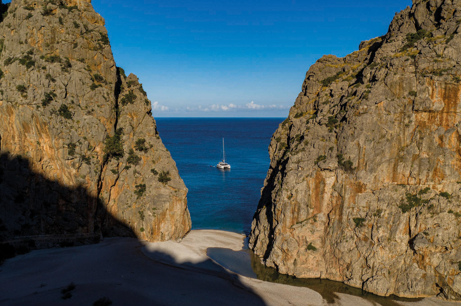
Mallorca - The magic of the calas
The built-up areas of the Balearic archipelago’s largest island are limited to a part of the south coast - whilst the north coast is almost deserted... You will almost have the warm and turquoise waters, the vertiginous cliffs, the cicadas and the palm trees to yourself!
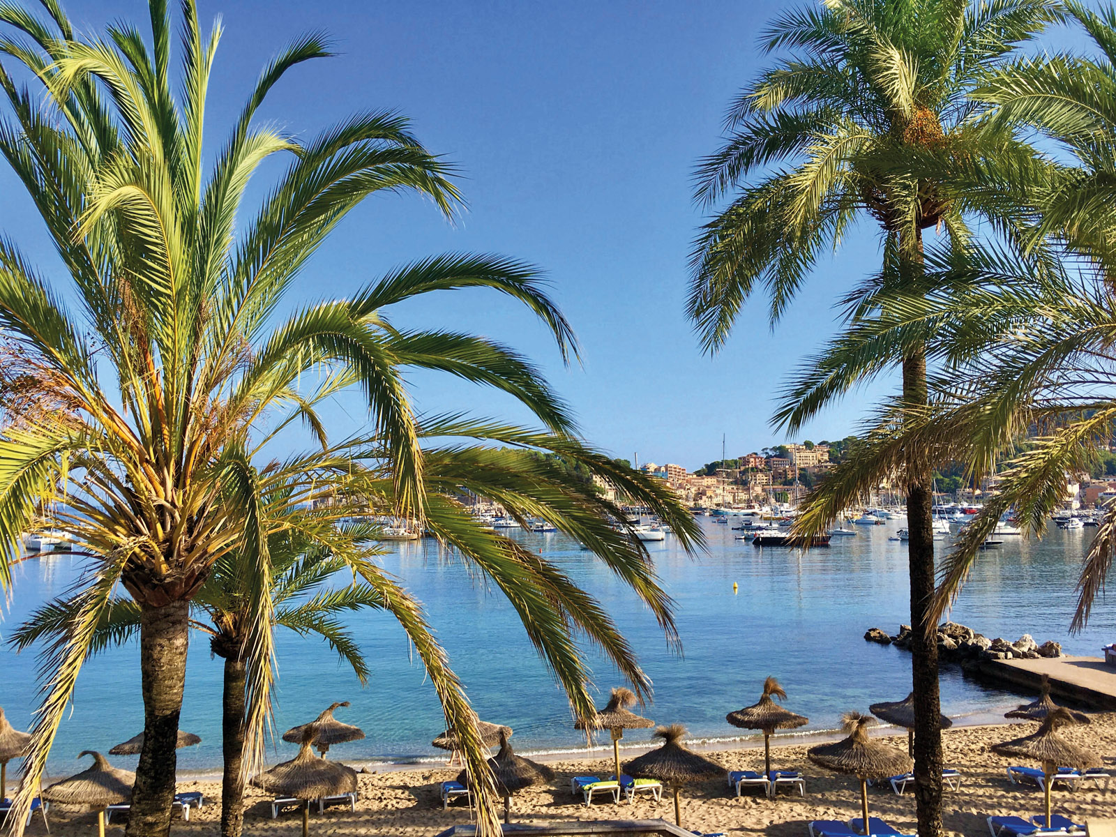
Here we are in the Mediterranean, 100 miles south of Barcelona. The Balearic archipelago offers many cruising possibilities: Ibiza to the south, about ten hours away by sea, and Menorca to the east, accessible in a half-day sail. But Mallorca alone justifies a week or two of sailing. Once you get past the apartment blocks in the bay of Palma, you will find an infinite number of coves, wild anchorages, picturesque harbors and, above all, the north coast and its imposing cliffs. Sailing all the way around Mallorca with a detour to the Cabrera Archipelago, means that you will cover around 200 miles. A more complete visit of the bays and coves - especially the deeper ones like Alcudia - can quickly increase the length of the journey. This cruise does not require any particular preparation - with one reservation: in July and August, it is preferable to choose an anchorage for the night in the late afternoon. The best periods to enjoy good weather without too many people are June and September/October. No tides, negligible currents and very few sand banks: cruising in Mallorca is as pleasant as it is easy. The only constraints are the swell and chop, which can make some anchorages difficult to handle. Generally speaking, you will no doubt be tempted to take advantage of the countless bays and coves - the calas. There are plenty of places where you can moor at the quayside and fill up with water and fuel. There are about 20 well-equipped harbors on Mallorca. There are enough good shelters to ensure a safe and quick retreat - with the exception of the north coast: of the 50 miles of spectacular cliffs and peaks, only Puerto Soller is accessible if the sea is rough.
 |
 |
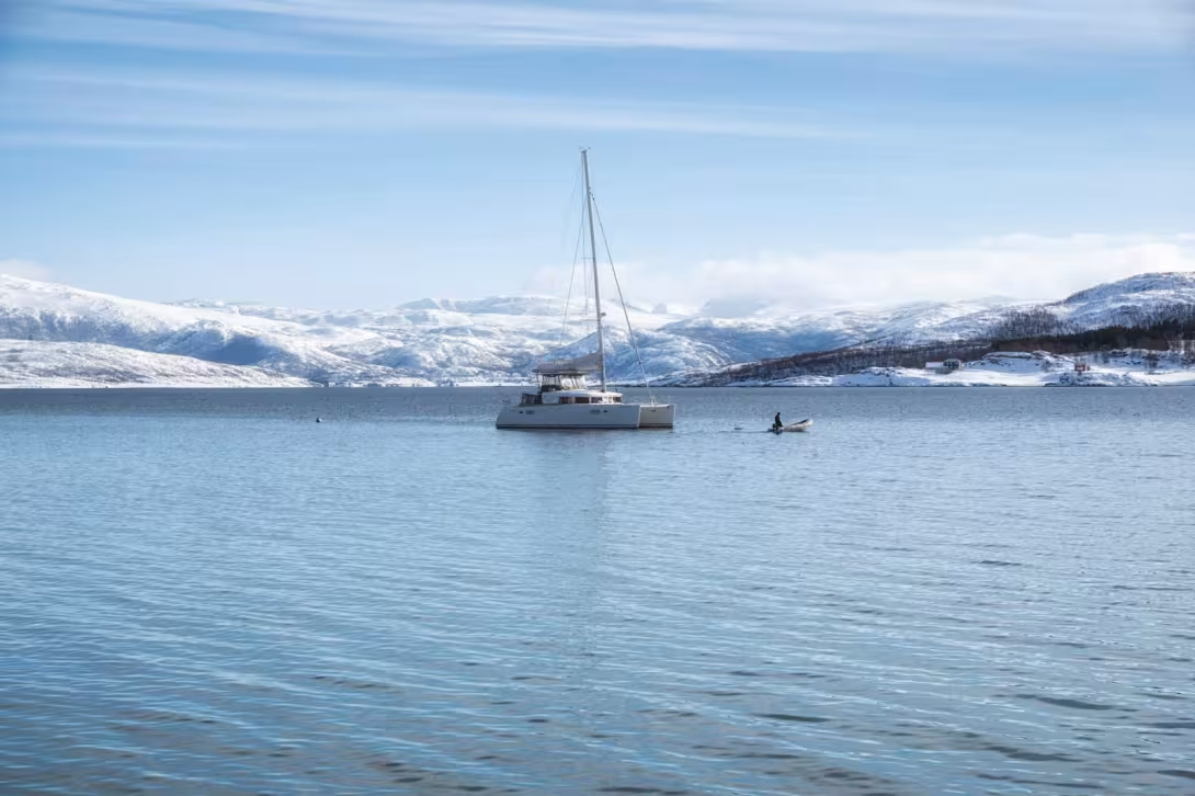
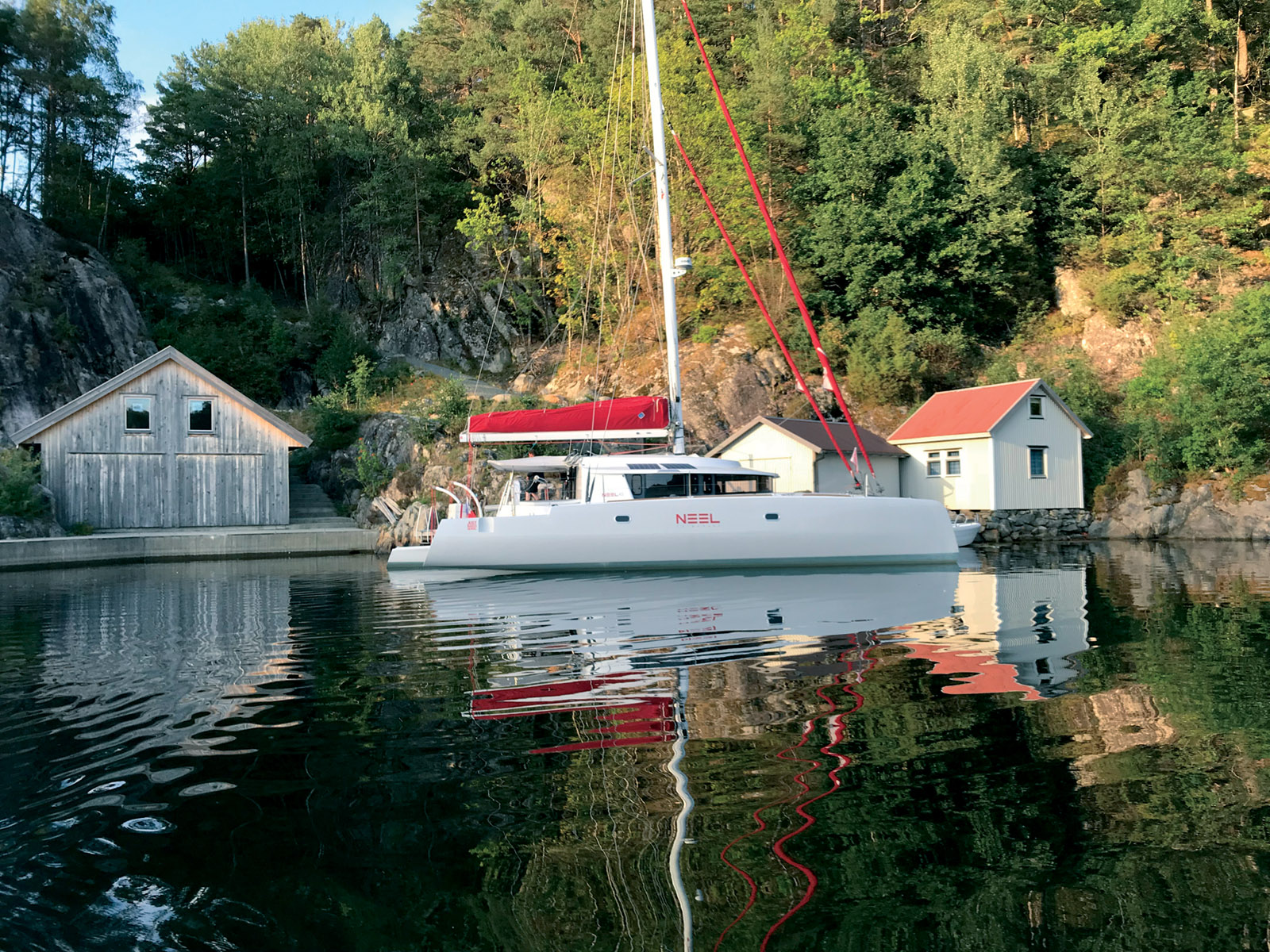
Norway - Northern lights or midnight sun?
If you want to discover the Nordic countries, you might as well go straight to the Arctic Circle. The route will lead you to Tromsø, Norway’s 8th largest city - but also the most northerly city in the world with more than 50,000 inhabitants at 69° North!
![]()
If you want to discover the Nordic countries, you might as well go straight to the Arctic Circle. The route will lead you to Tromsø, Norway’s 8th largest city - but also the most northerly city in the world with more than 50,000 inhabitants at 69° North! Contrary to what a glance at the chart would lead you to believe, the sea does not freeze here. The Gulf Stream does its job and maintains a minimum of 41°F (5°C)... So, while Tromsø is located 220 mi (350 km) north of the Arctic Circle, it is possible to sail all year long! Don’t forget that for two months, from November 21st to January 21st, the sun stays below the horizon. You should also bring a good heater because it is still very cold and it snows a lot... One nice consolation is that from October to March you can observe the incredible Northern Lights from here. Late March and early April are the best periods to see whales and orcas. At the other extreme, the sun does not set from May 21 to July 21 - two magical months when the weather is a little less harsh. Tromsø, the gateway to the Arctic Ocean, offers the chance to take on some extraordinary journeys, such as to the island of Senja, to the southwest. «We are now in a maze of islands and peninsulas,» says Julien, on board his Lagoon 450 Arctic Princess. «The landscapes are magnificent. On each side, snow-covered peaks border the sea. At the foot, small fishing villages seem to be clinging to the mountains. Sometimes, there are shallows or rocky outcrops that force us to make big detours to get back to our arrival points, because the fjords are huge. The waves, the arctic wind and the driving, horizontal snow sometimes present a spectacle as majestic as it is disturbing. We all remember a splendid night at anchor contemplating the northern lights. We discovered sumptuous landscapes that words struggle to describe. For example, on the way back, we moored in a superb bay bordered by cliffs and a magical beach. The water was transparent and emerald green. At the water’s edge, there were multicolored houses facing us. The place is simply magnificent. We often got out the fishing rods, trying to catch the cod. We even had a memorable swim north of the Arctic circle, in water that was 6-8°C [43-46°F]. The Arctic aboard a catamaran is possible, exciting and exotic: an adventure to add to your sailing bucket list!»
 |
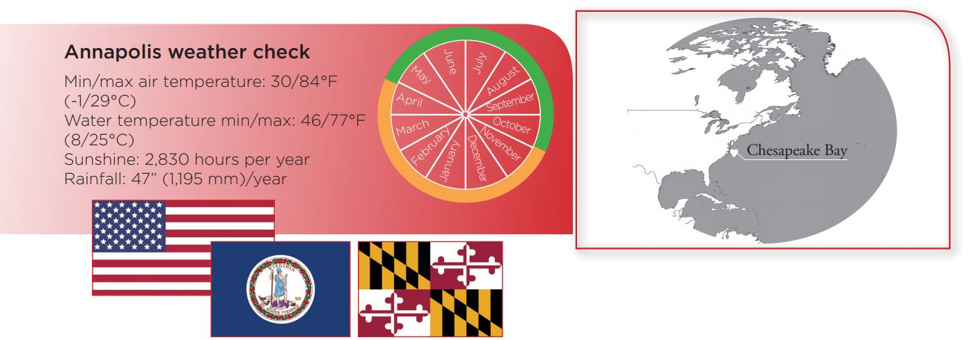
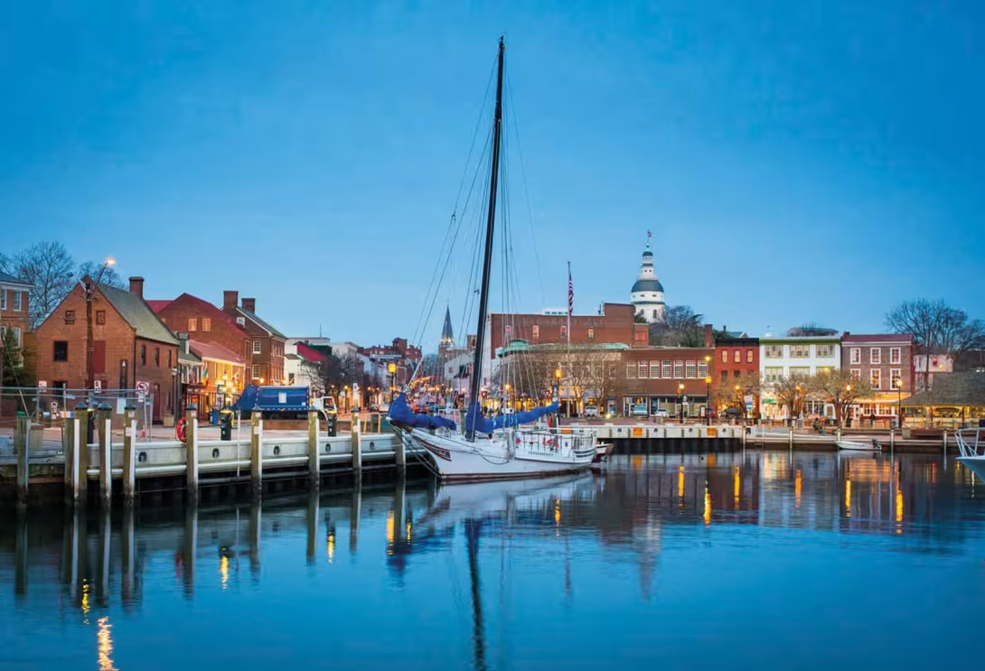
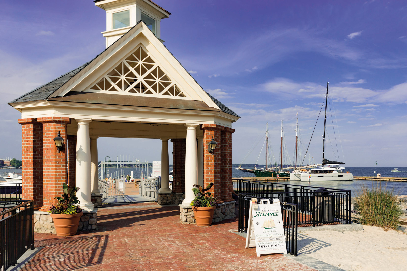
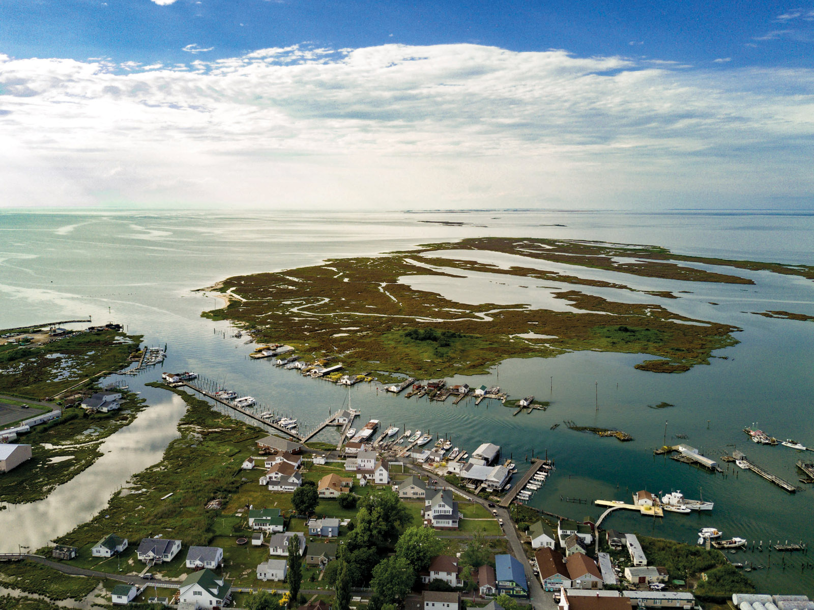
USA - We can’t get enough of Chesapeake Bay
This deep indentation southeast of Washington extends over 150 miles from north to south. Chesapeake Bay is not only an exceptional area to discover, but also a good alternative during the hurricane season in the Caribbean.
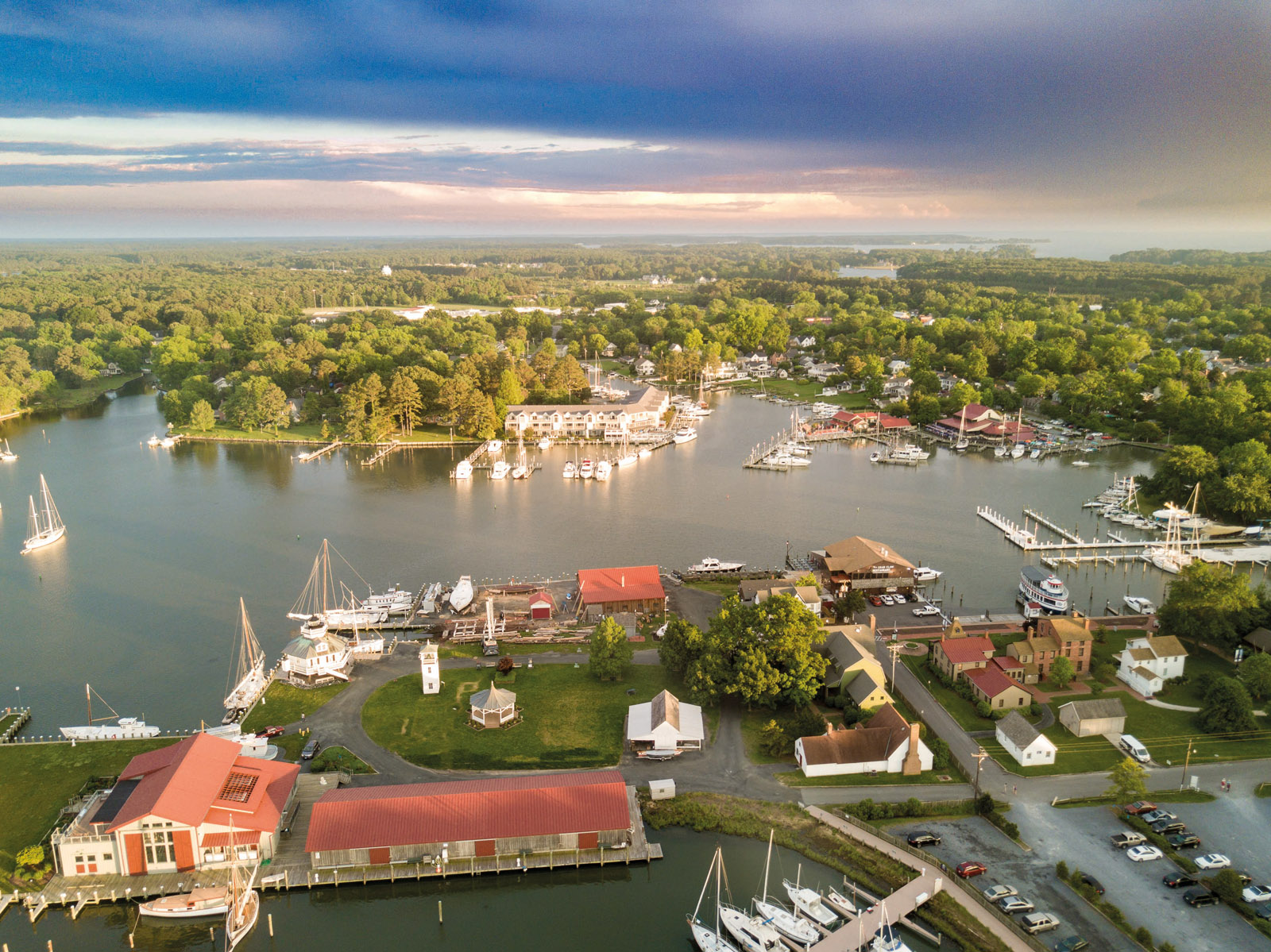
In June, when the Atlantic hurricane season approaches, the classic option usually takes touring multihulls south - Grenada, Colombia, Rio Dulce. There are numerous options. Unfortunately, safety concerns are still ongoing in some of these areas. Whether on the way out or the way back, there are coasts that are best avoided. The East coast of the United States is a reasonable and attractive alternative. Getting up there is generally quite easy thanks to the powerful Gulf Stream, while going south means skimming the coast or going offshore. For those who don’t know, this East Coast sailing area is famous for its blue crabs, which often end up as delicious crab cakes! Chesapeake Bay is the largest estuary in the United States and lies between the states of Virginia and Maryland. It’s a huge sailing area since with its main tributaries, it covers 4,500 square miles (11,600 km²). It would appear that the impact of a giant meteorite 35 million years ago is partly responsible for this XXL size. The bay is also full of much more recent - but no less exciting - historical sites. It is nearly 20 miles wide in the south, near the mouth, and 3.5 miles wide to the north, across from Annapolis. The state capital of Maryland, with its international boat shows, is a mecca for boating in all its forms. Sailing in the bay is fairly easy. However, you have to be careful with the tidal currents, which are quite strong in some places, and of course with the crab pots...
 |
 |