We all know that the majority of the marine charts that we use are obsolete or incomplete and only partially meet the requirements of the new satellite positioning techniques, which are disconcertingly accurate... We therefore have to continue observing, and look up from our screens when sailing!
Image
1
/
1
Publié le
06/02/2017
Par
Jean-Christophe Guillaumin
Numéro :
Previous issues
Parution :
Jan.
/
Feb.
2013

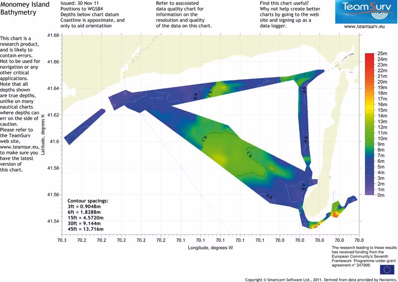
TeamSurv is a ‘crowd sourcing’ project whose aim is to improve the depth data on marine charts, by asking volunteer sailors to take a little time to send in their observations.
Boats of all types and sizes record the data and send them via internet to be processed, then put at the disposal of the SHOM (France’s mapping agency) and other scientific establishments likely to use them. The more data TeamSurv obtain for an area, the more precise the grid for it will be.
The data recording equipment is loaned free of charge, and all the participants are free to access all the data.
Wherever you are sailing, if you would like to join the 250 boats supporting this project, just visit: www.teamsurv.eu
