Dutch explorer Abel Tasman, the first European to set foot on Tasmania in 1642, thought he had discovered an uncharted part of continental Australia. He was wrong, as the British George Bass and Matthew Flindlers proved in 1778, when they circumnavigated Tasmania for the first time: it is an island, and we intended to sail around it too!
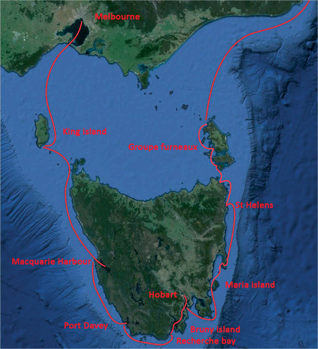
The waters of the South Pacific, close to the Roaring Forties, are not usually on the agenda of a round-the-world voyage under sail, but Covid offered us the opportunity to discover some seldom-visited places. With the help of La Niña, the southern latitudes of New Zealand and Australia experienced climatic conditions that were highly favorable for sailing in these southern seas. That’s how Cat’leya, having left Sydney in January 2023, arrived in Melbourne to prepare for a circumnavigation of Tasmania.
From Port Philip Bay to King Island
Only 110 miles separate King Island from north-west Tasmania, where 140,000 wallabies, thousands of cattle, a penguin breeding ground and 1,600 human beings await us. But the Bass Strait is no laughing matter, so we took every precaution when leaving Port Philip Bay to avoid the huge waves that can be created by the combination of sudden changes in depth and the opposing current. Despite our caution, when we reached the exit of the bay in the channel, Cat’leya was picked up by 6 to 10-foot (2 to 3-meter) waves, and I was glad that she was equipped with two 80 HP engines which enabled us to keep going... Fortunately, it didn’t last very long, but the swell remained, making for an uncomfortable crossing!
Cape Wickham and its lighthouse, on the northern tip of King Island, would be our first contact with Tasmania. In the 19th century, this was a staging post for the transport of migrants and convicts between England and Australia. More than 60 shipwrecks were recorded in these waters, which eventually led to the construction of the lighthouse. Built of stone in 1861, the lighthouse stands 157 feet (48 m) high, making it Australia’s tallest lighthouse. Painted white, the lighthouse is now automated; its 1,000 W light has a range of 24 miles. At the time, Bass Strait was a shortcut between England and Sydney (by about a week), but strong winds, uncertain currents, inaccurate charts, imprecise navigational aids and reefs and rocks jutting out more than a mile from the shore exacted a heavy toll on those who used it... We’re well into the Roaring Forties here!
The West Coast : Macquarie Harbour and Port Davey
Tasmania’s west coast has a reputation for being exposed to north-westerly swells, and sheltered ports such as Macquarie Harbour and Port Davey are few and far between for those adventurous souls who sail here. After 20 hours’ sailing, we found ourselves at Hells Gates, the entrance to the former. Macquarie Harbour was a former British penal colony on Sarah Island, used between 1822 and 1833. It had the reputation of being one of Australia’s harshest colonies, as the ocean and surrounding land were so inhospitable that it seemed impossible to escape. So the name of the entrance to the channel, “The Gates of Hell”, refers not to the site’s danger, but to its brutal reputation...
From Macquarie Harbour, it’s possible to take a 20-mile trip up the Gordon River: one of the most popular local activities.
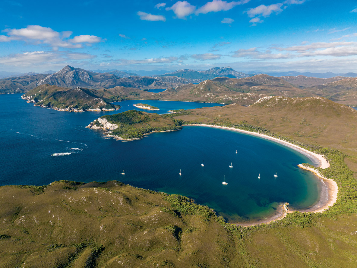
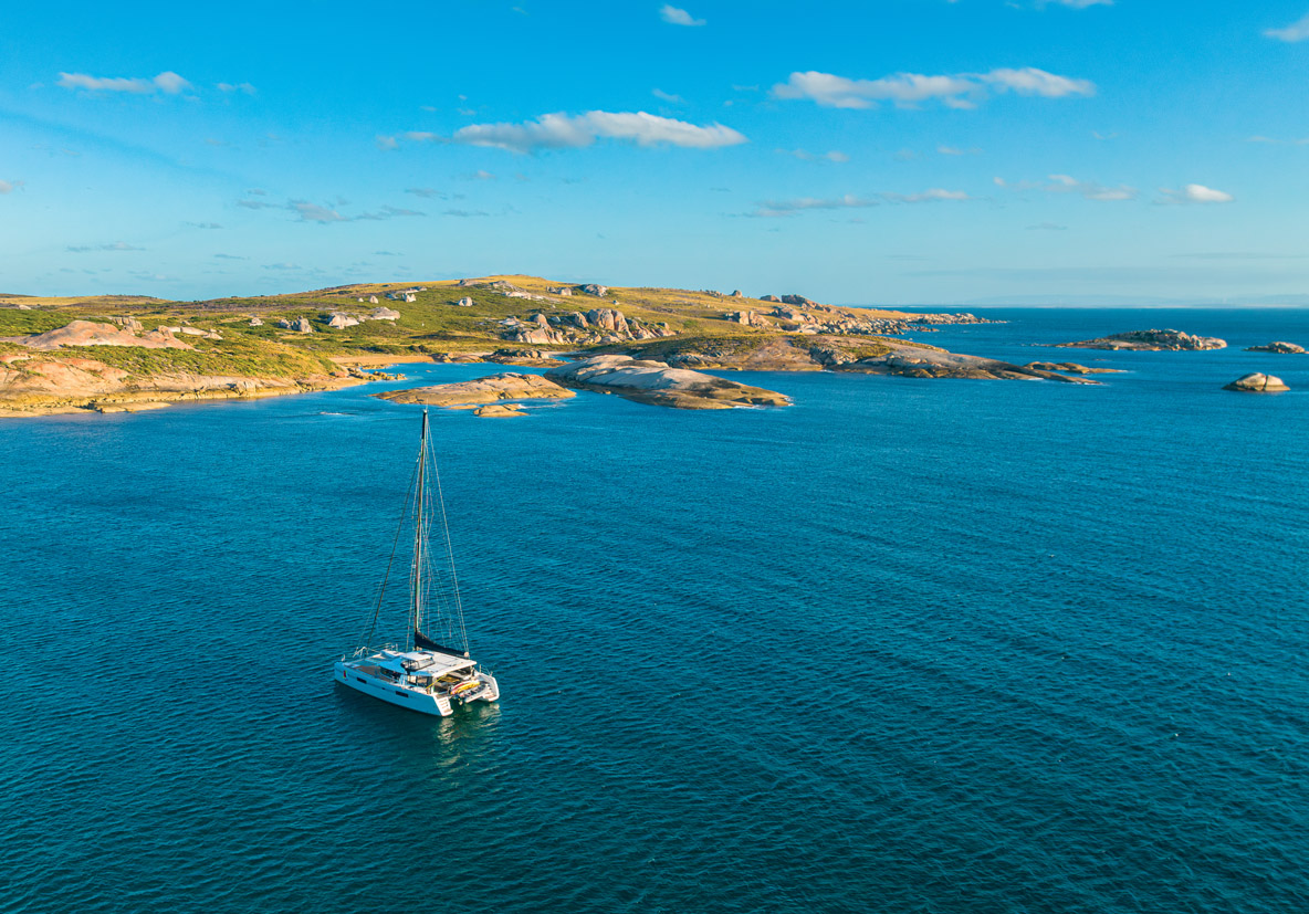
Further south is Port Davey, Tasmania’s ultimate destination. There are no roads in this area, only a few footpaths and a runway for tourist aircraft. Nature here is wild and magnificent: this is the part of Tasmania most like Stewart Island (south of New Zealand), with its rugged granite peaks and sparse vegetation.
The Southern Coast: Bruny Island and Hobart
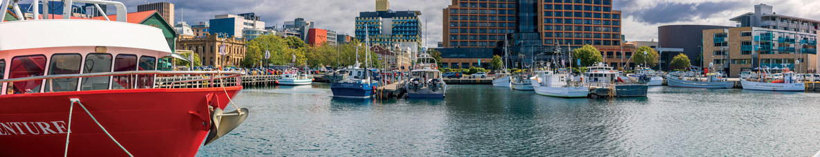
After skirting the South West Cape and then the South Cape, we were now at 43 degrees south, on our way to the east coast and the d’Entrecasteaux Channel. The latter owes its name to the Frenchman Antoine Bruny d’Entrecasteaux, who set off in search of the La Pérouse expedition in 1791. He landed here in a bay he christened Recherche Bay, and discovered that today’s Bruny Island was indeed an island. From Bruny we took the Derwent estuary for the 10-mile sail to Hobart. We too have done the Sydney-Hobart route, but in our own way: in 1 month instead of the 2 days needed by the best in the race!
We were thinking of going to Constitution Dock, the pontoon where visitors can moor, but unfortunately the swing bridge that gives access to it isn’t wide enough for Cat’leya... In the end, we took a berth at the Royal Yacht Club of Tasmania, just below Mount Wellington, which dominates the city and is even draped in a mantle of white frost on some cool summer nights!
Hobart’s history is intrinsically linked to whaling and sealing, as well as trade with China and shipbuilding. However, in the early days of its occupation by England, it was essentially a land of exile for convicts after the loss of the American colonies. The Industrial Revolution created a huge unemployment crisis in the English countryside, whose precarious workforce flocked to the towns, where poverty gradually developed. Faced with an increase in petty theft and violence, the justice system became so severe that the simple theft of an apple could get you sent to a penal colony! Ships returning to Europe after “delivering” convicts were encouraged to trade seal skins with China to make the return trip more profitable, while the oil extracted from whales was used to light London and New York. Shipbuilding boomed with the development of these activities.
The East Coast : Tasman Island, Maria Island and the Freycinet Peninsula
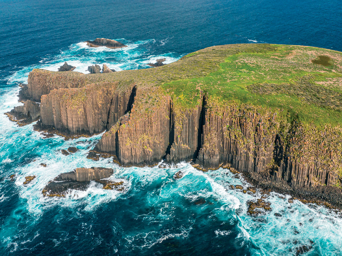
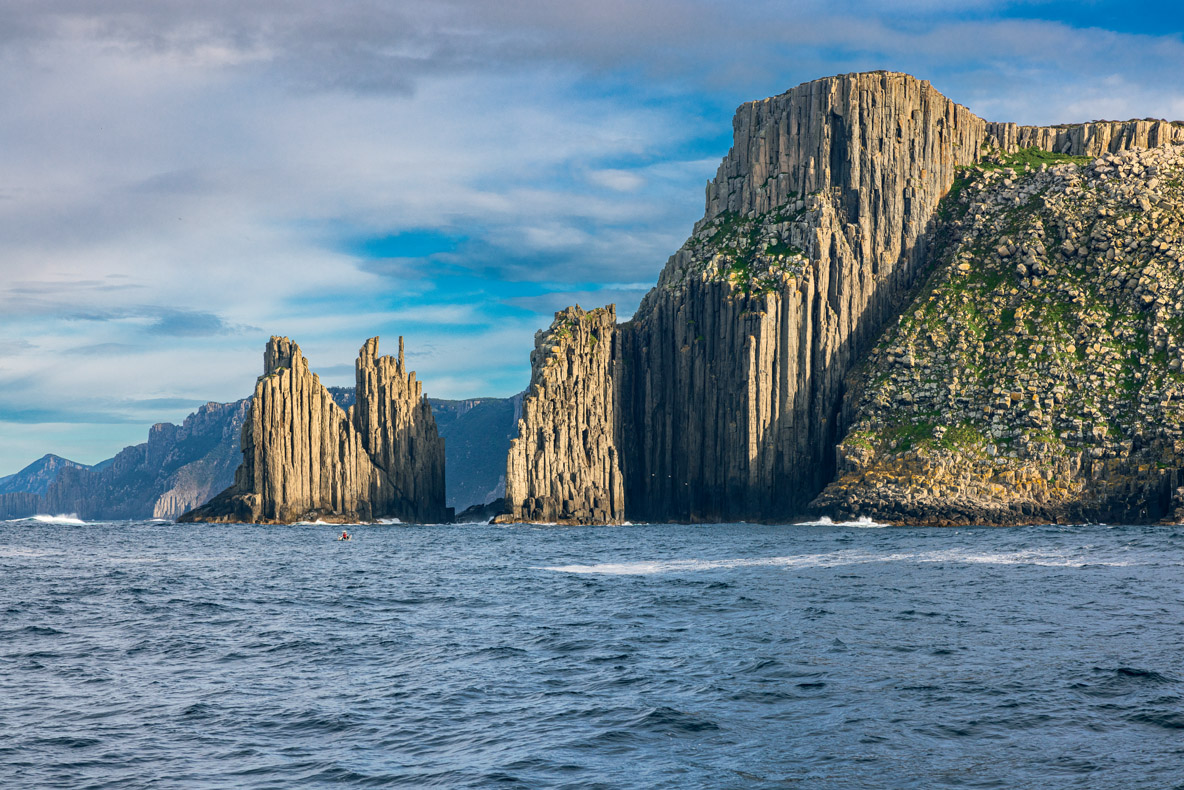
After Hobart, the coast of Tasman Island is made up of giant organ-shaped dolerite cliffs, the wildest in Tasmania. Some of the names are famous: Cathedral Rock, The Lanterns... When the Sydney-Hobart participants catch sight of these rocks, they get a real sense of relief, as they know that they have crossed Bass Strait and are now sailing south along Tasmania’s east coast, into the Roaring Forties...
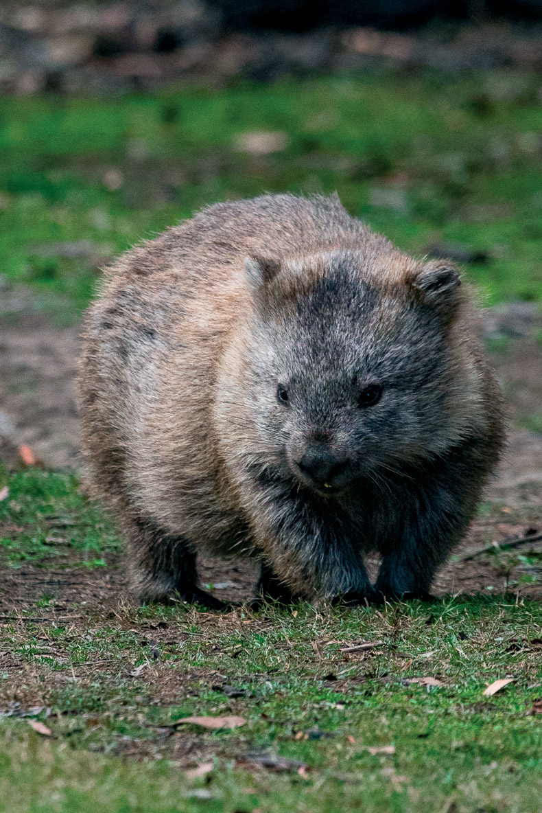
Our next stop was Maria Island, where we anchored off French Farms and set off on a hike to see the birds and the wombats, which are burrowing marsupials with heads reminiscent of koalas. The sunsets here are memorable too!
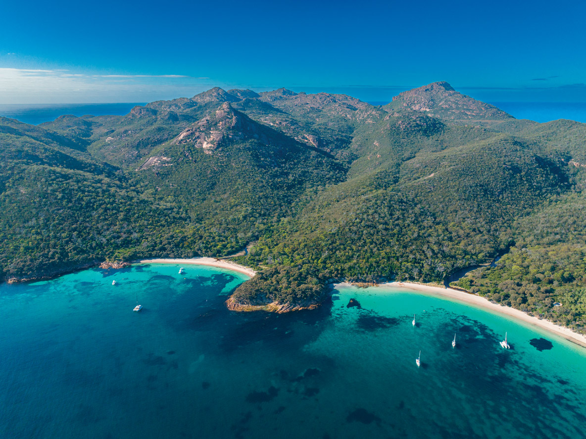
Twenty miles further north is the Freycinet Peninsula. A beautiful anchorage awaited us north of Schouten Island at Crocketts Bay, and then Bryans Corner, where we caught oysters and scallops.
But it was already mid-March and we had to think about heading for Australia. On our way would be the Furneaux Group of islands, an archipelago northeast of Tasmania that would merit several weeks’ exploration in itself... So we left the Freycinet Peninsula for St. Helens, a natural inland port whose entrance is protected by a particularly nasty bar. When we arrived, we were lucky to find a fishing boat at the entrance, offering to guide us! The entrance to the pass is not easy to negotiate, and the channel can be quite narrow. It’s best to be extremely cautious in this kind of situation...
Heading North Back To The Australian Continent
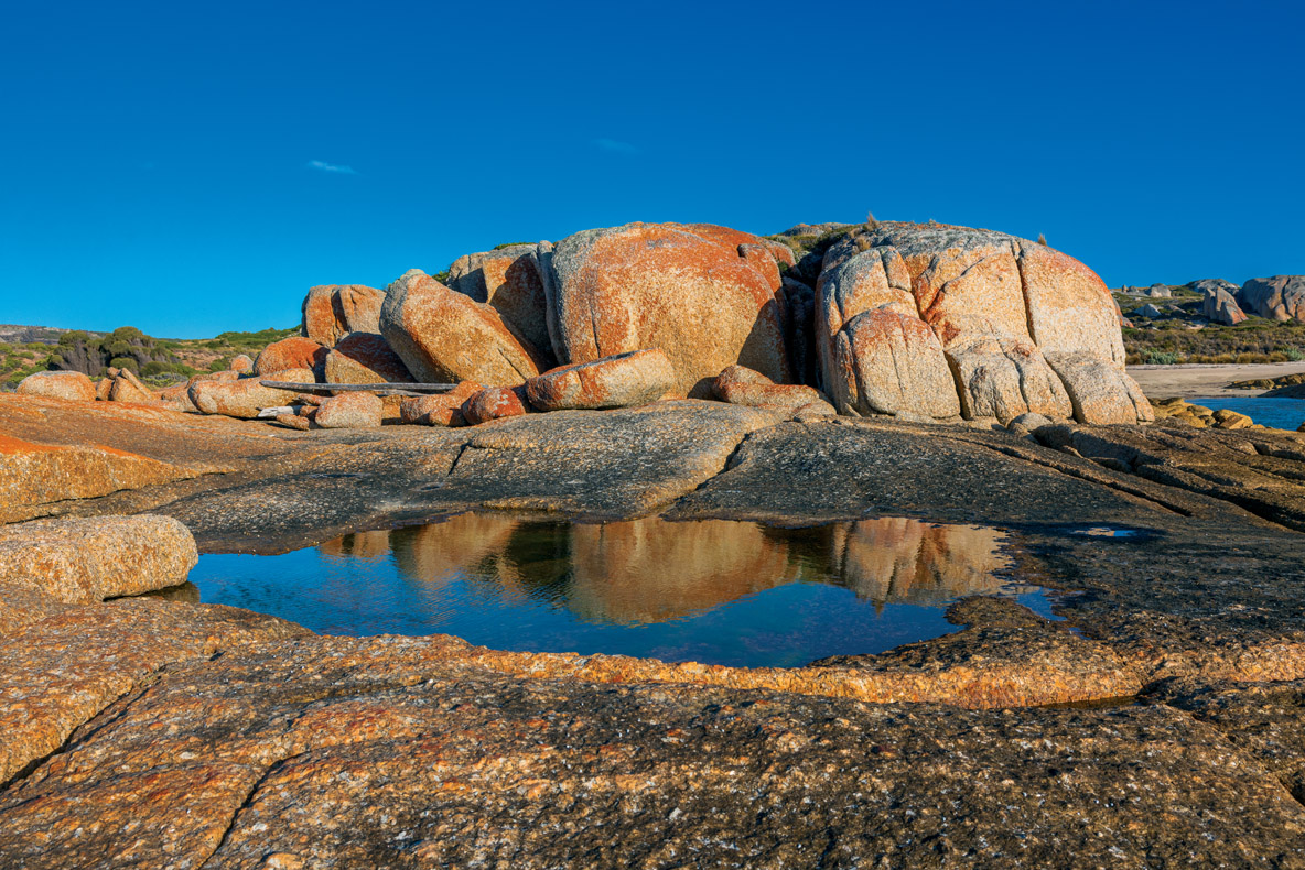
After a few days of waiting, a new weather window opened up, allowing us to leave St Helens for northern Tasmania. We anchored in Spike Bay, just opposite Spike Island, which protected us from the swell. Several lobster fishing boats had taken refuge here, and we met up with the Good Samaritan who guided us into St. Helens. From the boat, the landscape of these round rocks colored with red lichen on a desert floor, was only enhanced by the sunset. During a walk ashore, we were captivated by this pastiche of colors.
So many wonderful encounters, discovering amazing flora and fauna and dazzling landscapes... In short, the 2500 nautical miles that we had sailed around Tasmania in 4 months were a pure delight!
Practical Information
Tasmania is an Australian state located 115 miles south of the mainland - the two lands are separated by the dreaded Bass Strait.
Tasmania covers 26,410 sq mi (68,401 km²) and includes more than 300 smaller satellite islands.
The state has a population of 539,590.
Tasmania’s capital is Hobart, in the south of the island, with a population of around 220,000.
Coordinates: 42° 53’ 09“ S - 147° 19’ 53“ E
Language: English
Currency: AUD (Australian Dollar) 1 US$ = 1.56 AU$
Driving: on the left
Main airport: Hobart, with Melbourne the most frequent connection
Weather Check
Hobart’s climate is oceanic, with mild winters (June, July and August) and relatively cool summers (December, January and February). Rainfall is fairly regular throughout the year.
Average min temperature: 9°C/48°F (min 5.2°C/41°F in August and max 13°C/55°F in January)
Average max temperature: 17.6°C/64°F (min 12.6°C/55°F in July and max 22.7°C/73°F in January)
Sunshine: 2,400 hours per year
Precipitation: 600 mm (23.6 in) per year
Useful Sources to Help Prepare for Your Trip
Books
Cruising Tasmania, J. Brettingham-Moore, 1988
Tasmania Cruising Guide, e-book available on jackandjude.com, 2020
Documentary film
Tasmania: Weird and Wonderful, David Attenborough, 2019