.")

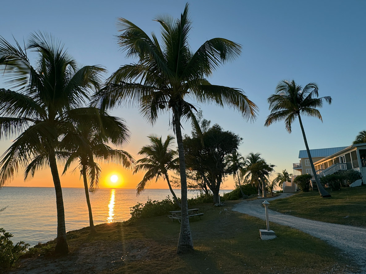
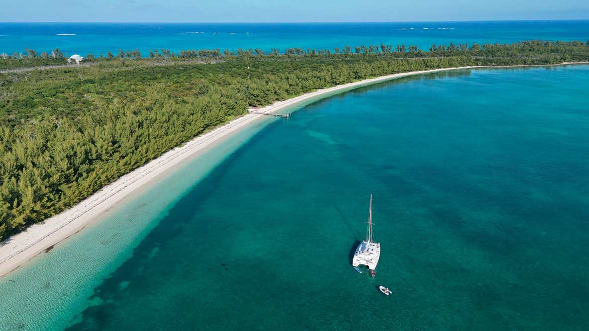
Enjoy! That’s certainly the word Bahamians say most often. Imagine the water in a swimming pool. The same color, but not just 40 feet by 25: here, the turquoise stretches for miles and miles. You’re leaving one island paradise for another, right in front of your bows. That’s sailing in the Abaco Islands, an archipelago in the northeast of the Bahamas.
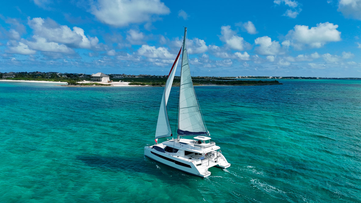
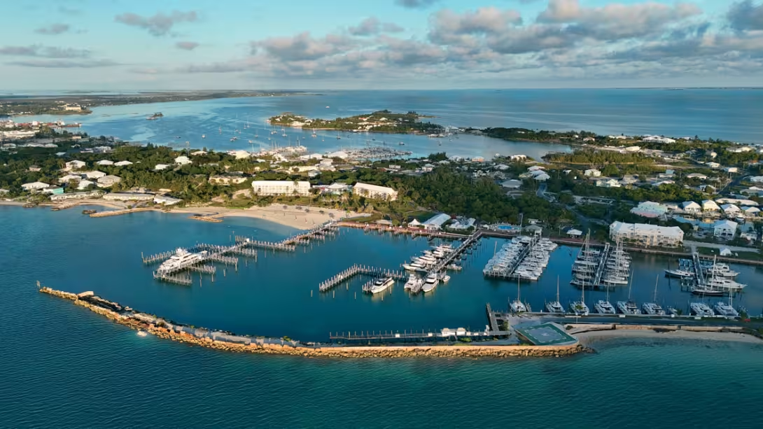
The Bahamas is an island nation that lies to the east and south-east of Florida, a good distance north of Cuba. By air, the main point of access is Nassau, the capital, but also Miami. On the water, the area to be discovered is immense: 100,000 square miles (260,000 km²), equivalent to the surface area of Colorado or Oregon. The Bahamas are more sea than land and the country has been independent since 1973. Only twenty or so islands are inhabited year-round. To the south is a succession of islets of sand and coral, with no possibility of revictualing. To the west, the Bimini Islands are the closest to the US coast (just 40 nautical miles). In the middle, Nassau is naturally the main island. Many charter companies are based here, as the Exumas archipelago is nearby (see our cruising article in Special Edition #23). To the east, the island of Great Abaco is protected by a long chain of elongated, flat islands - it’s here, at Marsh Harbour, close to the airport, that numerous facilities have been built for boaters. Most charter companies are based here, including Sunsail, with whom we booked a 454 (Leopard 45). The marina, the restaurant and the whole environment are brand new. The base I knew back in 2011 no longer exists, thanks to Dorian, a category 5 hurricane that hit the archipelago on September 1, 2019. With winds of up to 183 mph (295 km/h) - and even gusts estimated at over 215 mph (350 km/h) - a powerful storm surge, raging seas and unprecedented rainfall, Dorian wreaked havoc that permanently disfigured and scarred the paradise that was Great Abaco. In just a few years, the archipelago has managed to heal most of its wounds, much to the delight of locals and visitors alike.
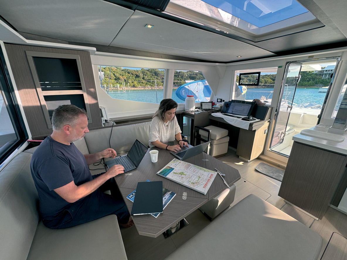
On the pontoons, Paul and I were greeted by Travis, the base manager, before being joined by Laura and Andy just before sunset.
Day 1 - Man-o-War Cay
The day began with us buying supplies at the local Maxwell’s Supermarket, with the aid of a cab. A little later, following our briefing, we found ourselves in a quandary: there are as many islands to discover to the north as there are to the south... And the wind wasn’t going to help with suggesting a course, as the sea was oily calm. In short, there was no risk of getting a rope burn from the sheets today! Nevertheless, we set course for Man-O-War Cay, to the north-east. After an hour under motor, we entered a narrow channel that widens out into two anchorage areas, both of which are equipped with numerous mooring balls that can be occupied for 30 dollars. In the event of a wind shift, beware of veering, as the boats are moored very close together. There’s a curious atmosphere ashore, as if we were in another world, another time. Here, there’s no bling, no alcohol, just simple living and enchanting gardens. It has to be said that Man-O-War Cay has a history all its own: this little rock, 2½ miles (4 km) long and 300 feet (100 m) wide, has been occupied since 1780 by Loyalists - 10% of the 80,000 English who refused Washington’s victory settled in the Bahamas, which helped the development of the archipelago. Long self-sufficient, the islanders of Man-O-War soon specialized in shipbuilding. And their houses, built like boats, are particularly resistant to hurricanes. Most of the 215 inhabitants are deeply religious.
We discovered narrow concrete lanes used by golf carts (which are available to rent) as we headed for the large white sandy beaches facing northwest. Andy’s first swim, even if the water is still a little chilly (72°F/22°C) in early February. We then collected and opened coconuts, discovered cotton and ate bananas. Heading towards the north-west of the island, you can enjoy an incredible view from an isthmus just 150 feet (50 m) wide: the ocean on one side, the lagoon on the other.
Day 2 – Treasure Cay
Wind at last! On day two, the trade winds were established out of the east, and even managed to pick up to 10/12 knots. We’d have to make do with that, as the forecast was calling for lighter winds later on. Hoisting the mainsail and unfurling the genoa, we were off with the wind well aft of the beam, on starboard tack. We skirted a few flat, deserted islets before reaching the popular Scotland Cay. Visible through binoculars, the signs are unequivocal: Private island. Please respect our privacy. Violators will be prosecuted. Only walking on the foreshore is tolerated, and even then... So, Scotland is a private island, with a small, equally private airport adjacent to an equally... private harbor. To the north, you can dinghy to an immense lagoon and magnificent beaches. We continued sailing, staying within sight of Great Guana Cay to the Titi sandbar, where we did our photo and video shoot under sail, tacking with the wind on the beam in water the color of a swimming pool. We then decided to head east towards Treasure Cay. Travis has warned us: the area is still hard hit by Dorian, but Sandy Banks Bay is, in his opinion, one of the most beautiful beaches in the Abacos. A little distracted on arrival, I entered the first channel to the east and nearly ran aground before I turned around: the main entrance is half a mile further west, and there, we discover a vast, almost deserted stretch of water with only a few wrecks. Despite the presence of many rebuilt houses, the docks remain empty. Here and there, we came across houses with nothing left but the rubble, gutted boats and abandoned cars. The atmosphere is a little strange, but the protection afforded by this anchorage is excellent. We headed ashore in front of what used to be a bar and discovered, just to the north, an incredible flour-white dune and a few coconut palms still standing. This is the prelude to the famous beach - it stretches for 3 miles (5 km) - which we surveyed all the way to its eastern end. Here, the seabed is so shallow that navigation is impossible. On the other hand, the water is a little warmer for swimming. Got 5 minutes? Stop for a cocktail and admire the view from the Bahama Beach Club Resort bar!
Day 3 - No Name Cay, Nunjack Cay and Green Turtle Cay
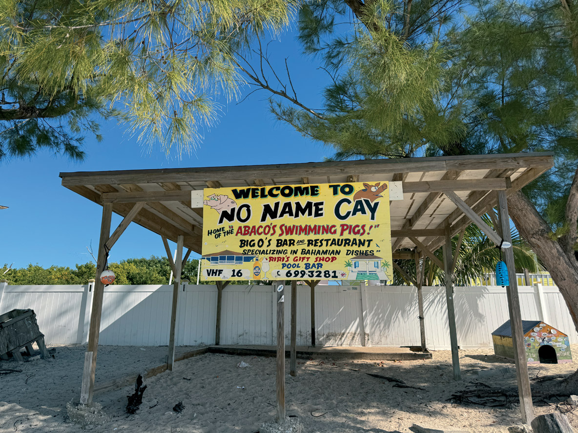
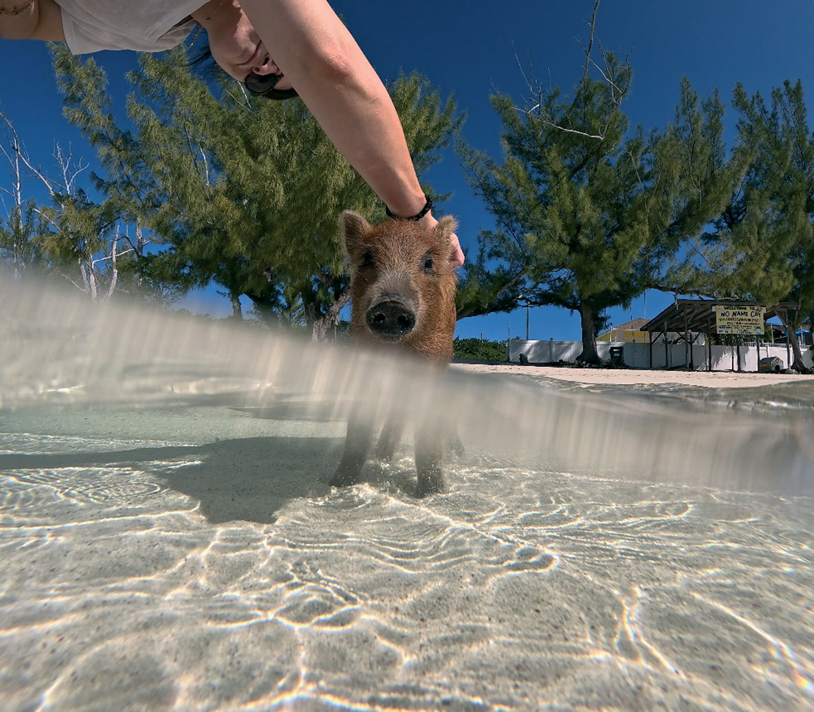
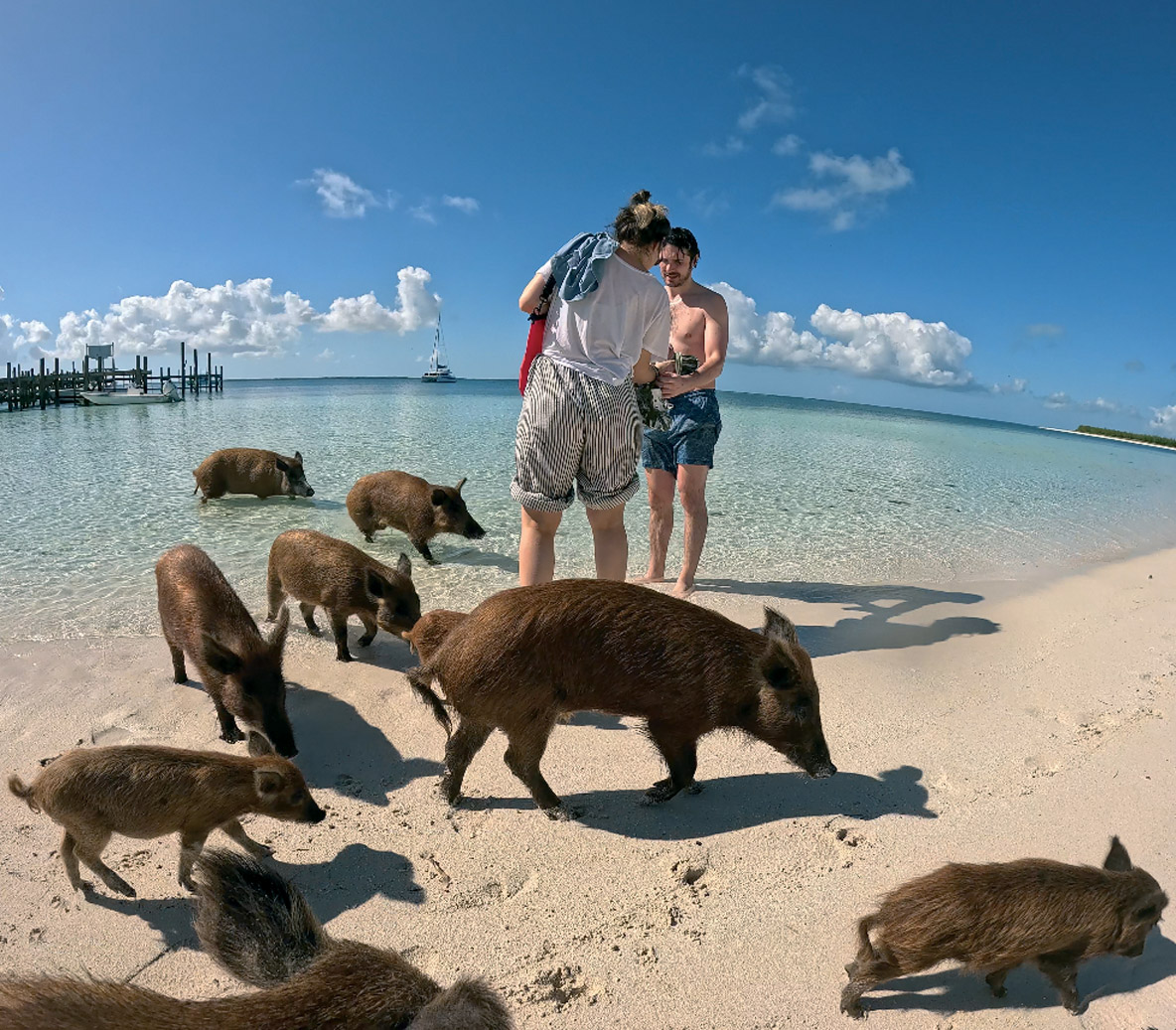
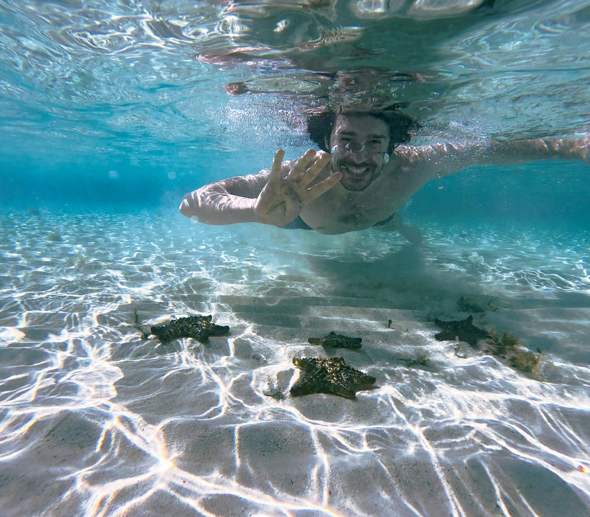
The sun was barely up when we cast off. Our first objective was to reach No Name Cay, and we immediately noticed that the part of the lagoon in which we were sailing was very shallow. In fact, there’s so little water between Treasure Cay and Whale Cay Island to the northeast that we had to go around it to the north via a channel off Guana Island, venturing a few miles offshore into the Atlantic before finding sheltered waters again. There is an inshore passage, but this can only be used at high tide and in winds of less than 20 knots. This option is forbidden by the charter company, who asked us to call when we were about to take the “offshore” route, and again 30 minutes later, when we’d finished. Even though the ocean was in a “calm” mood, we carefully secured everything we could. As we reached the northern end of the passage, we realized how narrow the channel is - be careful in this area. Back in the lagoon, we rounded the large sandbar south of No Name Cay, where we visited the pigs on the eastern side of the island. From the anchorage, we headed to a lovely wooden jetty with the dinghy. Ashore, we discovered a pretty beach bar/restaurant for those wishing to take a longer break on the spot. Around 30 pigs are on hand to greet you as soon as you arrive at the pontoon. Several piglets mingle with the adults and ask for a piece of apple or just a little petting. The animals don’t mind getting into the water, but unlike the pigs so familiar from the Exumas further south, they keep their feet between the starfish and don’t seem to actually swim for real.
We set sail again, skirting Green Turtle Cay, then Crab Cay and Nunjack Cay, the northernmost point of our cruise. We first discovered a wild anchorage to the east, before making landfall again at Nunjack Beach, near a small jetty. We stretched our legs on a sandy path that leads straight to the ocean, where we met a Canadian skipper who showed us where we could swim with stingrays and lemon sharks, just a little further west. Kayaks and paddleboards were out once again: this is where we discover extraordinary underwater fauna! At around 4 in the afternoon, we set sail for Green Turtle Cay. For the night, this island offers two perfectly sheltered anchorages, Black Sound to the east, but we opted for White Sound to the west, where a second shallow shelter is accessible. Ashore, there are pontoons with bars and restaurants. The view across the lagoon to the south-west is magnificent at sunset.
Day 4 – Great Guana Cay and Elbow Cay
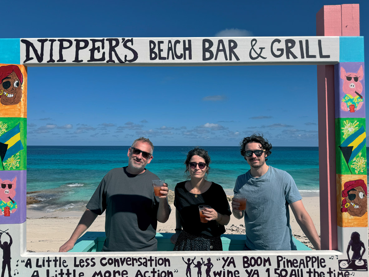
For our early-morning departure, all eyes were mobilized to avoid colliding with the turtles frolicking around our catamaran. So there we were, on a course that was bringing us closer to the charter base - which we called up again as we entered and left the “ocean” passage around Whale Cay. With the swell on the quarter, we moved about a little, but nothing too serious. On reaching Great Guana Cay, we dropped the hook in the central anchorage, protected by a point to the east and an islet to the south. On foot, we walked along a vast harbor area to the east before turning north towards the ocean beaches: this is where we discovered the famous Nippers Beach. This bar on the sand dune offers an extraordinary view and a direct atmosphere with its pink, green, turquoise and purple colors... a true concentration of the Bahamian spirit!
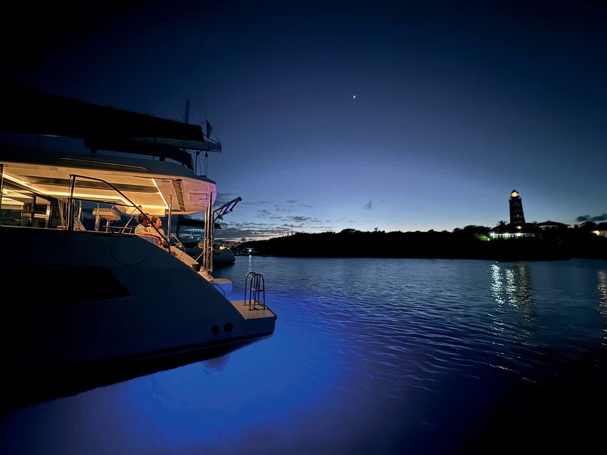
After lunch, a light breeze sweeps across the lagoon, so we decided to sail, even though the wind was almost directly in line with our course. In the distance, we made out Hope Town lighthouse - this red-and-white edifice is undoubtedly the most emblematic of the Abacos. After an hour and a half sailing, we entered a shallow channel leading to a large, somewhat crowded anchorage: welcome to Elbow Cay! Occupied by the British as early as 1785, the island was the administrative center of the Abacos archipelago until 1960. What remains of this rich history is a charming village and the famous stripey lighthouse. The building is well worth a visit. It’s free, and the view, more than 120 feet off the ground, is superb. Hope Town lighthouse, still manually operated, is said to be the last kerosene-powered lighthouse in the world. Strolling through the lively and colorful town is a pleasure; the people we met, locals and visitors alike, were all smiling and greeting us. The best bar is undoubtedly Captain Jack’s: the pink building is extended by a vast terrace on stilts, where the party continues long into the evening.
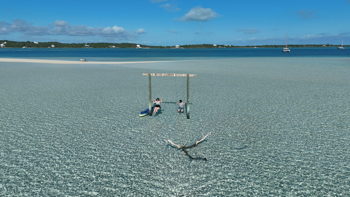
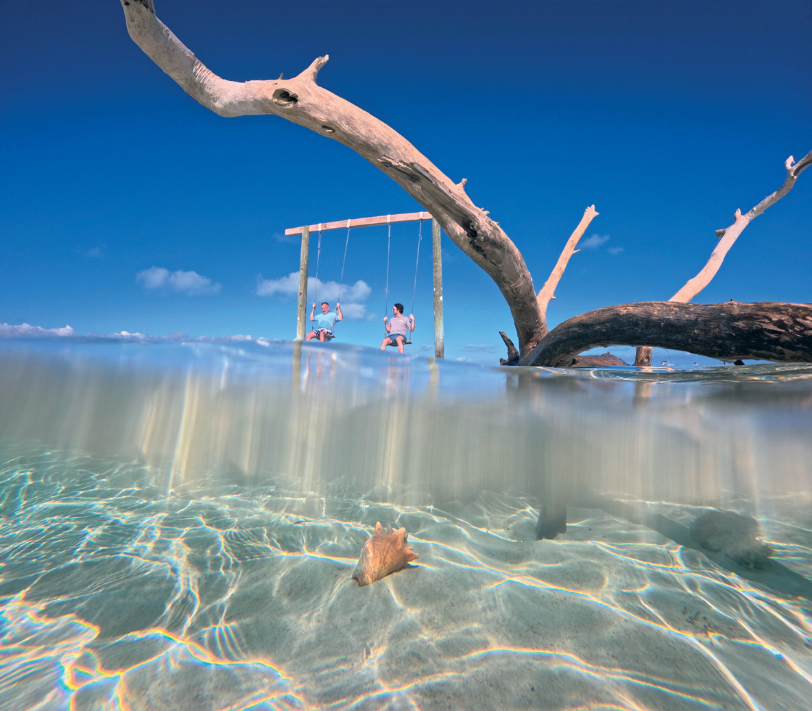
Day 5 – Tahiti Beach and Little Harbour
Our mooring buoy was ideally located just in front of the lighthouse, making it well worth a sunrise photo session, so we were ready early to head for the famous sandbar of Tahiti Beach, a little further south. It worked out well, as we were still alone when we got there and the tide still high, making it an absolute paradise. A picture postcard effect was guaranteed, with coconut palms in the background, and there was even a swing to take souvenir photos in influencer mode. For just over an hour, we enjoyed this extraordinary stopover all to ourselves. But as the sun climbed higher into the sky and the sand became more and more exposed, boats began arriving from all over, with their crews taking possession of the ephemeral sand island and enjoying the fact that the sand was uncovered to spread out their towels, set up tents and open their parasols. It was time we weighed anchor... The passage between Lubbers Quarters and Elbow Cay is very shallow as you head south, then, as you sail along Tilloo Cay, you find a little more depth beneath the keels. Further south, a huge sandbar forces you to describe an S to follow the channel. We rounded a small island with a red-and-white striped structure - obviously a reference to the Hope Town lighthouse. Our route continued unhindered through a landscape that was becoming increasingly wild - there’s no Internet in the area, by the way. In the late afternoon, thanks to the high tide, we reached Little Harbour. The very shallow channel calls for serious vigilance, especially near spring tides. The vast bay we discovered was the southernmost point of our cruise. It’s a particularly peaceful spot and seems to have been much less affected by Hurricane Dorian - witness the large number of coconut palms lining the water’s edge and the presence of a few relatively old houses. On the compacted sand road, large ropes act as speed bumps. The must-visit bar here is Pete’s Pub and Gallery. The establishment stretches from its bay-side pier to a wooden walkway leading down to the ocean. With our feet in the sand, we order a Blaster, Pete’s signature rum-based cocktail.
Day 6 – Return to the Charter Base at Marsh Harbour
Even though our schedule for the day - getting back to the Sunsail base - didn’t require us to get up early, Paul and I were up before the sun even emerged from the horizon, as the tide was already beginning to fall. And we’re not the only ones on deck: in the channel, sailboats are already escaping and, for a few minutes, have exchanged their anchor lights for their navigation lights. Having reached the channel ourselves, we could easily guess the destinations of those escaping eastwards on the high seas: Nassau and Eleuthera. We were almost alone in the lagoon, heading north. To starboard, Lynyard Cay stretches out over deserted white-sand beaches, with only a few boats at anchor. A little higher up, Sandy Cay is a popular stopover, but the rounded beach of Pelican Bay, just to the west, is far more spectacular. Even further north, there’s Tillo Cay and a beautiful anchorage just south of the pass that separates the island from Elbow Cay. It was time for the last kayak trip, the last paddleboard ride and the last swim, before setting sail for Marsh Harbour. Fenders and docklines were in place as one of the Sunsail crew helped us tie up to the fuel dock and then to our mooring ball. Soon it was time to say goodbye to Travis and his crew. More adventures were awaiting us in Miami!
Navigation Be Careful not to Go Aground!
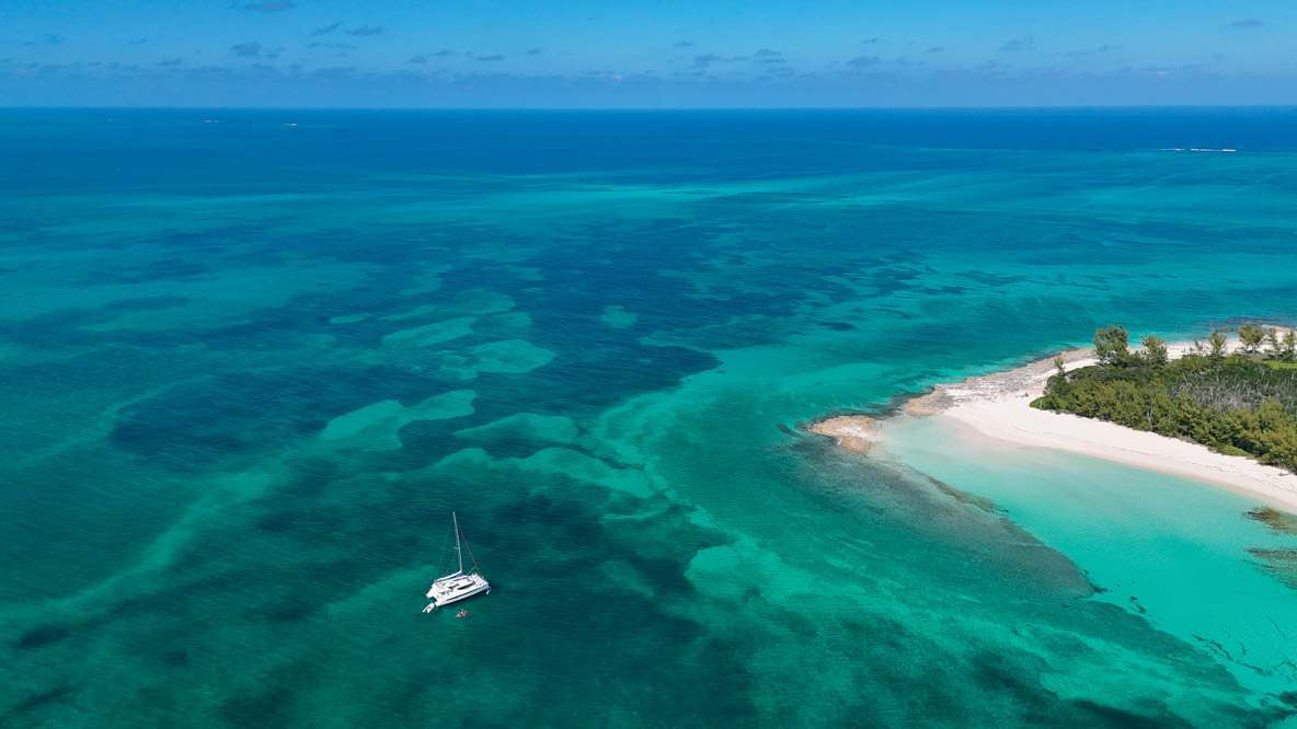
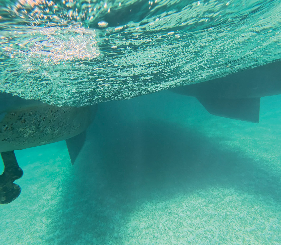
Generally speaking, the Abacos archipelago can be considered a relatively easy area to navigate. One of the only problems you may encounter is the shallowness of certain stretches of water and some of the access channels. Generally speaking, the water on the leeward side of the islands is so transparent that you always think you’re about to run aground. But then you get used to it: lying on the trampoline, you can see starfish, sea urchins and manta rays. A little stress when the turquoise turns to light beige: “We’re about to ram both hulls in the sand, aren’t we?” The sounder on our Sunsail 454 was showing zero feet. I dipped our GoPro in the water, pointing the lens toward the keels: it’s okay, there’s still a good 10 inches! Clearly you need to remain vigilant in certain areas - one eye keeping a lookout and the other on the chart - especially on a falling tide (tidal ranges of up to a meter / just over three feet have been recorded). In many anchorages and passages, the depth is reduced to 5 feet (1.5 m), which explains why monohulls over 40 feet (12 m) are virtually non-existent - to the benefit of our multihulls, of course.
Weather Check
Marsh Harbour: Not so Hot in Winter
The Abacos archipelago is slightly north of the Tropic of Cancer and can be a little cool from December through March, with average air temperatures of 70 to 72°F (21 to 22°C) and water temperatures of 75°F (24°C). At night, temperatures drop to just below 68°F (20°C). But winter is also the driest period. Less than 1.6 inches (40 mm) of water per month... compared with 6.9 in (175 mm) for August! In summer, of course, it’s much hotter, with average temperatures reaching 82°F (28°C). The water can even rise to 84°F (29°C)... But it’s hurricane season. What about the wind? The trade winds here are mostly easterly and moderate: 9/10 knots on average. In March and April, however, the wind instrument can indicate 20 knots. Choose this period if you want to have the time of your life aboard a multihull! The low month in the Abacos is September. This is the end of summer vacations as well as the period of maximum hurricane risk. The season really picks up in November, when many boaters - most of them from the US - who headed home to sail the East Coast during the summer, return to their favorite playground.
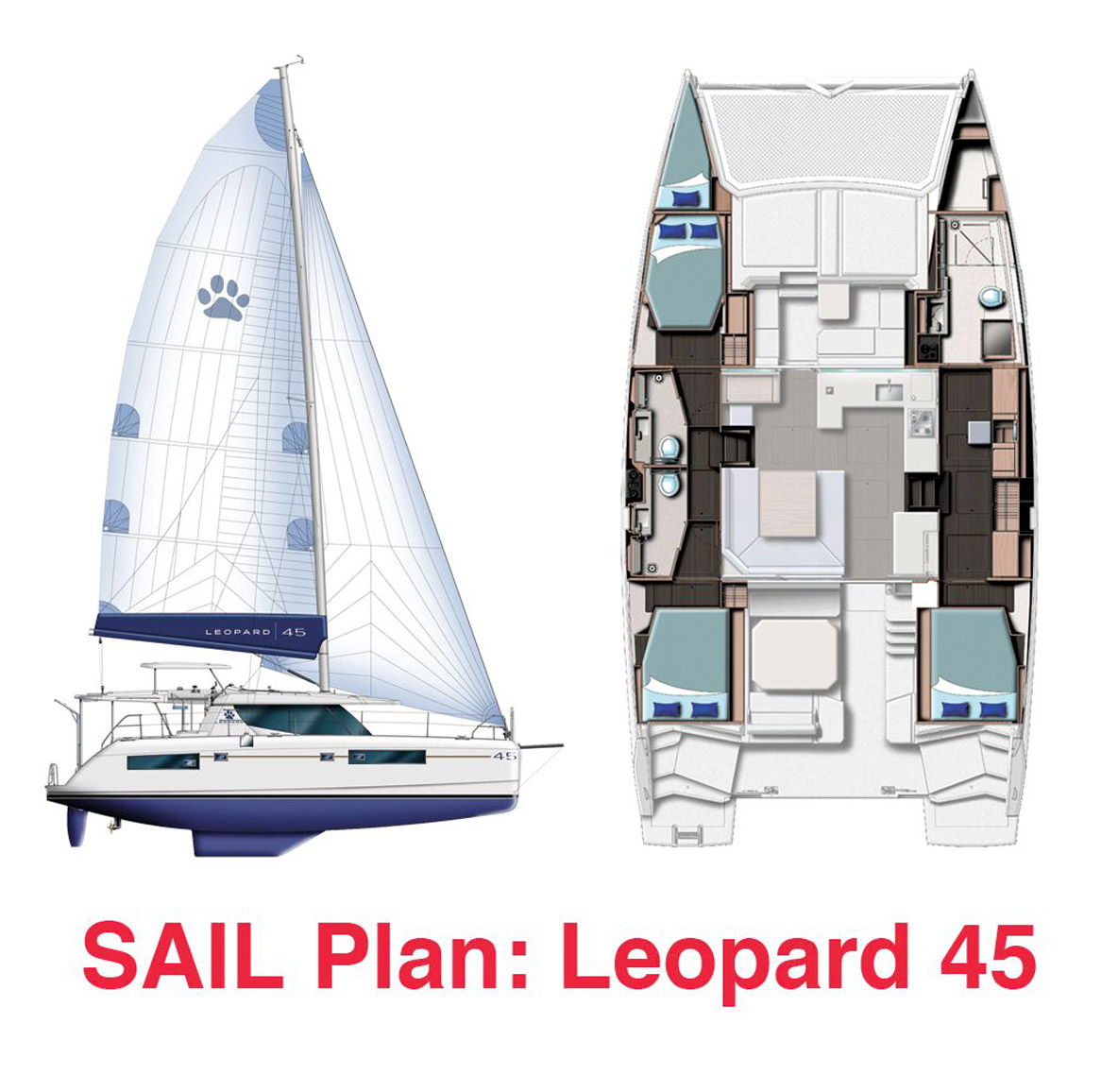
Sunsail 454 A Safe Bet for Charter and Owners Alike
The Sunsail 454, also known as the 4500 at The Moorings, is based on the proven Leopard 45. This catamaran, now replaced by the 46, was very popular, with nearly 400 units produced in 7 years. This Simonis & Voogd design strikes a good balance between comfort and performance, and remains easy to manage, even short-handed. Admittedly, in charter configuration with Dacron® sails, fixed propellers and no downwind sails, the Leopard 45 will seem a little suppressed in light airs... there’s nothing to stop you, if you find a suitable second-hand sail, from giving it some wings!
Technical specifications
Builder: Robertson & Caine
Architects: Simonis & Voogd Yacht Design
Overall length: 45’ (13.72 m)
Waterline length: 42’11” (13.07 m)
Beam: 24’2” (7.36 m)Draft: 4’11” (1.5 m)
Air draft: 70’ (21.34 m)
Bridgedeck clearance: 2’9” (0.83 m)
Displacement: 36,156 lbs (16.4 t)
Load capacity: 10,141 lbs (4.6 t)
Sail area: 1,344 sq ft (124.9 m²)
Engines: 2 x 55 HP Yanmar
Fuel: 185 US gal (700 l)
Water: 206 US gal (780 l)
Black water: 45 US gal (170 l)
Production: 368 examples from 2017 to 2024