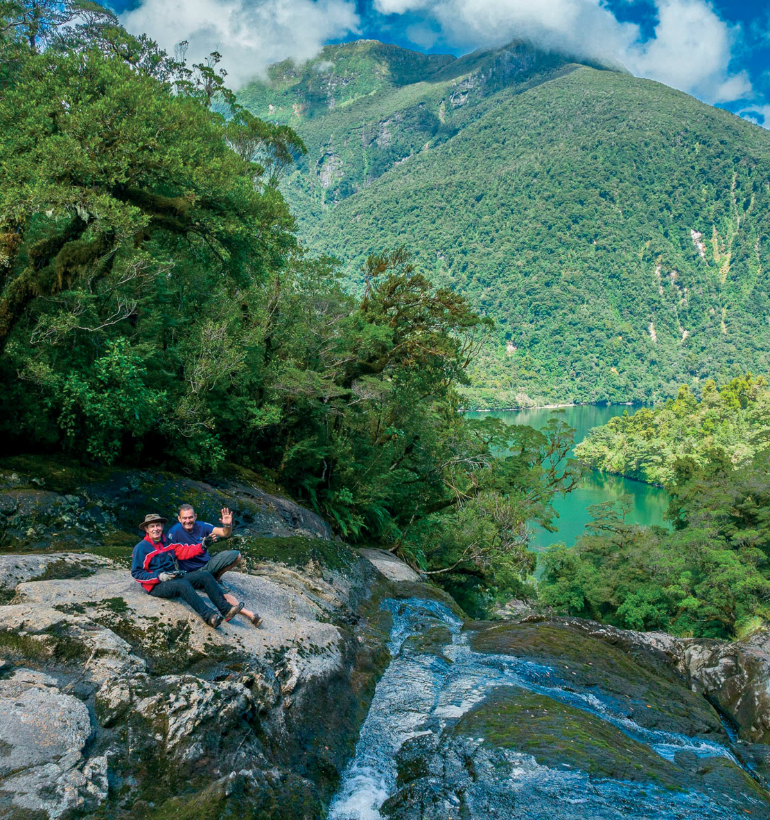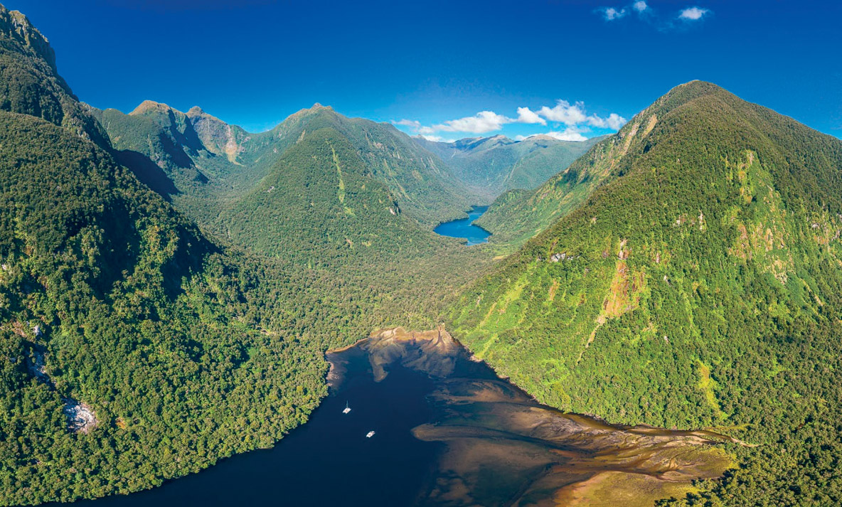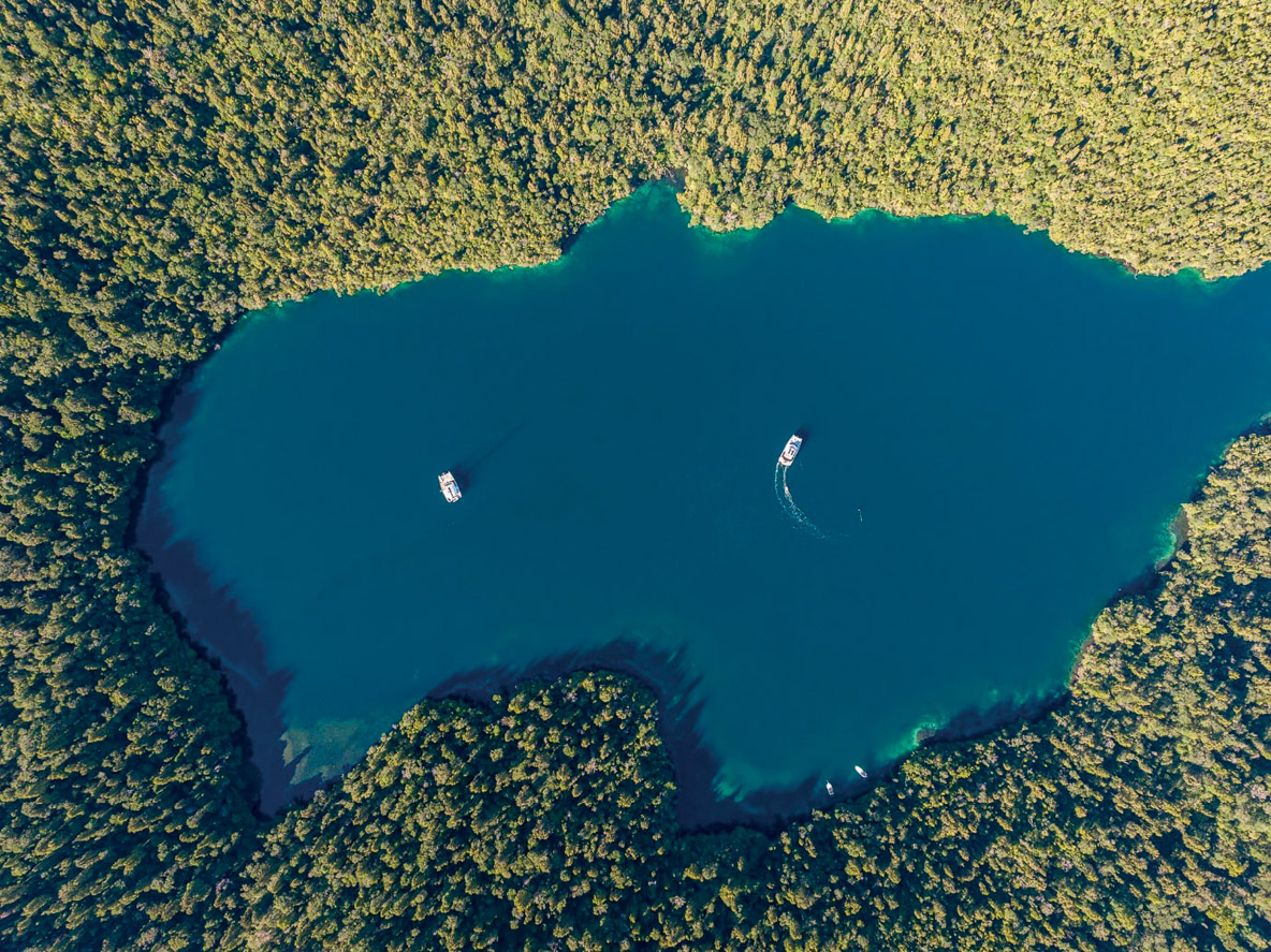


Less than 8 miles south of Bligh Sound lies George Sound, probably the most protected fiord in Fiordland. The Maori named it Te Houhou (the five-fingered tree), after its five arms, one of which leads to Alice Falls. We’re heading for the first arm, Anchorage Cove. With over 200 days of rain a year, or 275 inches/7,000 mm of water, the marine environment is exceptionally diverse and structured. The freshwater, which is less dense, takes up the first few fathoms below the surface. This layer is very tannic and often colonized by algae, providing very little light. Next comes the interface layer with the salt water, where the mixture of salinity impedes the progression of light and makes visibility almost non-existent. Below this is the seawater, where we find flora and fauna that would normally only be found at much greater depths. The entrance to the fiords, which is much brighter, has a more ‘normal’ seabed whose development is influenced by the ever-present offshore swell: white, black and red coral, cod, green algae, spiny starfish and tarakihi. We’re gradually getting used to navigating these channels bordered by high mountains, and even my drone, which can fly at up to 1,600 feet/500 meters, is nowhere near the peaks that surround us!
Charles Sound
We leave George Sound and set sail for Charles Sound. Once again, this fiord was named by the Australian navigator John Grono, this time in memory of Charles McLaren, captain of the Sydney Cove, a seal-hunting vessel that navigated the fiords in the 1810s.
After a breezy night in Gold Arm (35 to 40 knots), we filled up with fresh water alongside a helicopter pad, where a pipe draws water from a nearby river. The next day, we set a course for the next branch of the sea: Emelius Arm. The night’s rain had created a plethora of waterfalls that lit up the steep, dark slopes around us. Our chosen anchorage is the River Irene estuary. We explored it in the dinghy and came across a «patrol» of black swans.
As we reached the entrance to Charles Sound, the birds alerted us to the underwater activity: bluefin tuna were hunting. It didn’t take us long to catch blue and red cod as well as two bluefin tuna!
Doubtful Harbour
The next day we departed Charles Sound for another fiord further south. The Māori name for this fiord is Patea, “the sound of silence”, but it was B ritish Captain James Cook who named it Doubtful Harbour on his first voyage to Fiordland in 1770. He thought it would be very difficult to sail out without an easterly wind, so he didn’t attempt to explore the area. After the rain of the previous few days, we were once again treated to a string of waterfalls all along Thompson Sound, the fiord through which we entered Doubtful Harbour. We decided to head for the very end, to Deep Cove, so named because it is so deep that there is no place to anchor. It’s a popular tourist destination and many charter boats organize excursions there. It is also possible to have groceries delivered and take an excursion to Lake Manapouri.
Doubtful Sound is one of only two fiords to be linked to Queenstown, the heart of the South Island, via a road, a ferry across Lake Manapouri and then another road. The construction of this road was the subject of much controversy. In 1950, an Australian company proposed setting up an aluminum smelter in Bluff using Australian bauxite from Queensland and hydroelectric power from a power plant on Lake Manapouri, thus realizing a project originally conceived back in 1904. A 10-kilometre/6.2-mile tunnel would be dug between the lake and Deep Cove to ensure the flow of water and therefore the necessary energy production, thanks to a difference in altitude of 166 meters/550 feet. The depth of Deep Cove would also make it possible to accommodate a ship large enough to carry the turbines. However, the engineers’ calculations proved to be wrong, so the number of turbines had to be increased and the tunnel enlarged... The already virulent opposition from the Maoris grew to such an extent that the project became an issue in the following national elections and brought down the government. In the end, a technical solution was found: improve the surface of the tunnel to reduce the drag and increase the water flow. The project went ahead, but the final cost was more than double the initial estimate, and construction took two and a half years.
The day before we set off again, we stopped off at Blanket Bay to top up our water tanks. This is the only facility in Fiordland designed for fishermen. They can stay here (hence the nickname “Blanket Bay Hotel”) and have access to fuel reserves and freezers for their catch.
Dusky Sound
We now headed for Breaksea Sound, the gateway to Dusky Sound: the two fiords are linked by the Acheron Passage. The south-westerly swell breaks over the area. Captain Cook gave it the name «Break-Sea-Island». It has two arms: Brougthon and Vancouver. The latter was originally named “Nobody Knows What” by Cook, as he had not had time to explore it and discover that it was in fact connected to Doubtful Sound. In 1791, Captain George Vancouver (who sailed along the west coast of Canada in search of the Northwest Passage and in whose honor Vancouver Island and the city of Vancouver were named) managed to complete his exploration and renamed it “Somebody Knows What”. It was later renamed after him.
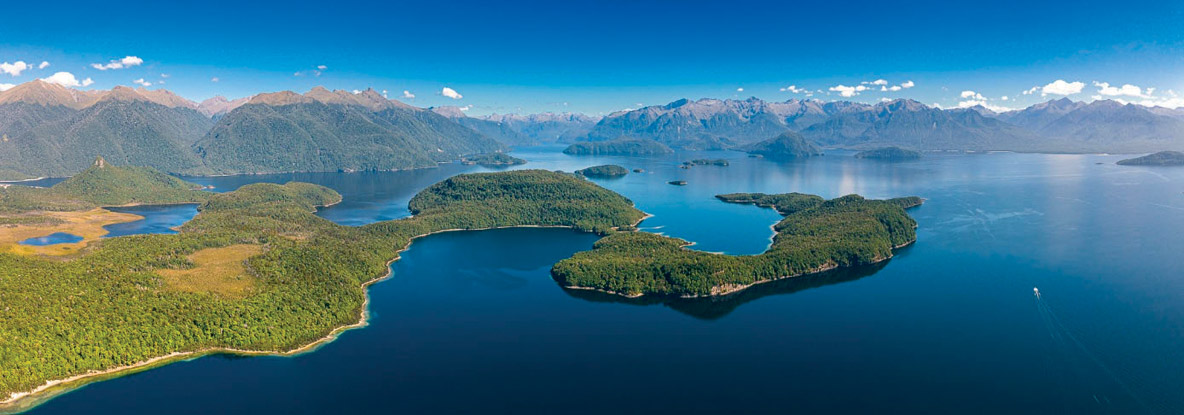
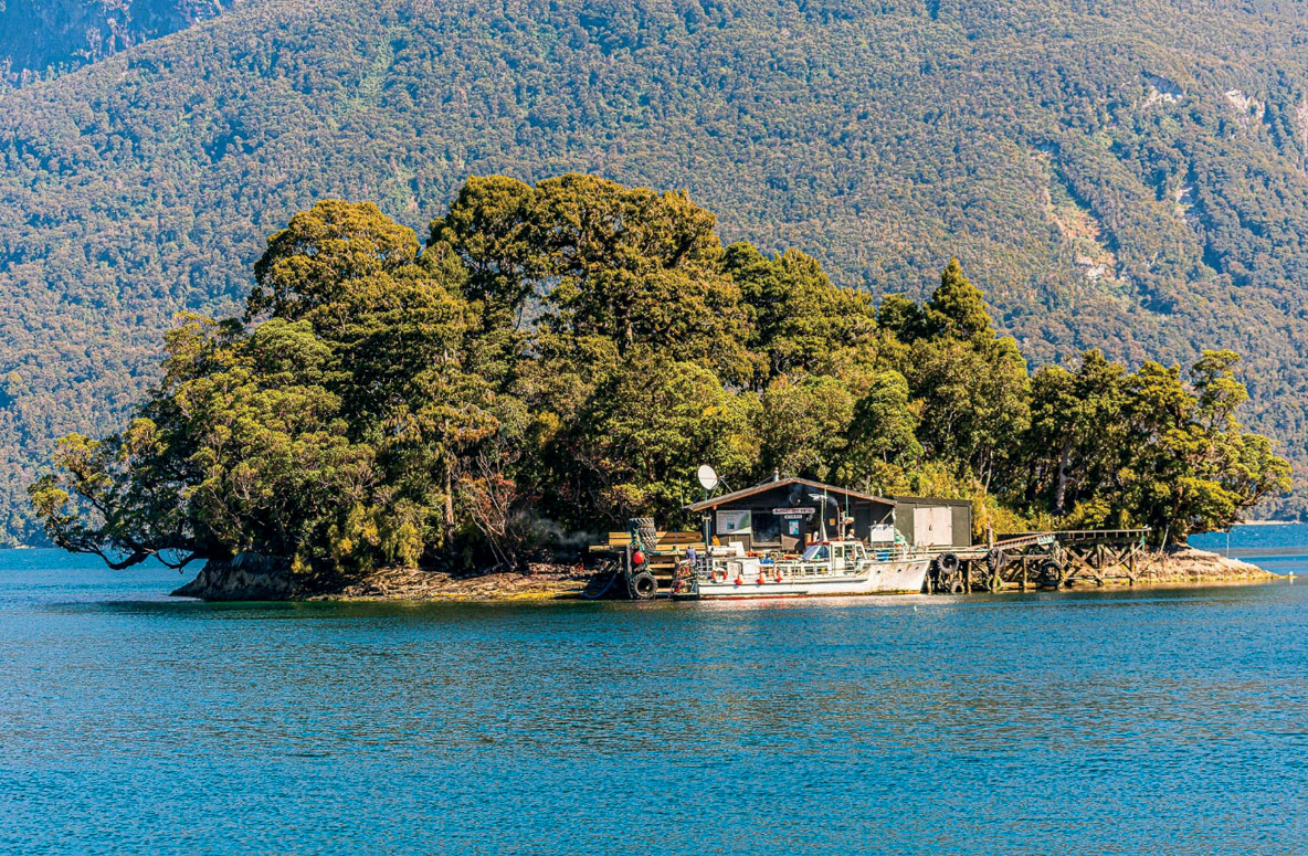
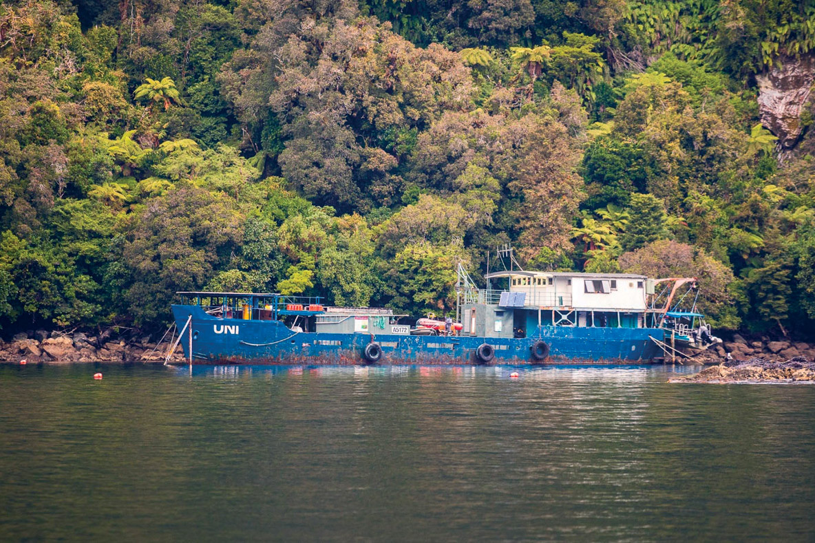
As we emerged from Acheron Passage, we passed Sunday Cove, where there is a barge that serves as a petrol pump for the fishermen. At 44 km/27 mi, this is the longest fiord, but above all the most «romantic»: its many islands are dotted like flowers in the sea, set against a backdrop of high mountains. But here, the high peaks don’t overwhelm visitors as they can in the fiords further to the north.
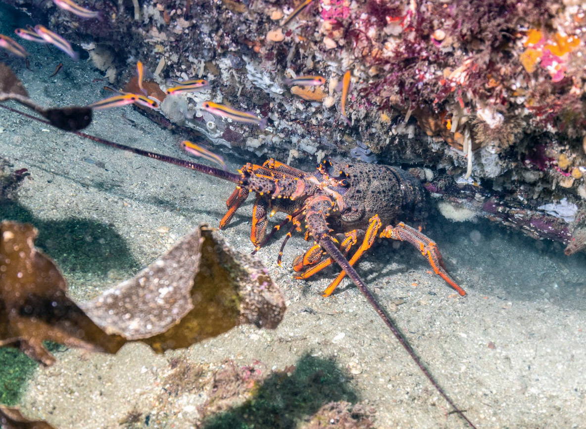
The next day, as we were about to leave, we had a bit of a scare: there were two of us who wanted to take the channel... Fortunately, the Milford Wanderer, a cruise ship that sails in Fiordland, spotted us before we set off and everything went smoothly. The neighboring island, Crayfish Island, looked like an interesting spot for a dive, and as its name suggests, there would be plenty of langoustines...
Facile Harbour
The next day, we headed towards the exit of Dusky Sound, Facile Harbour... From here, we could admire the mouth of the fiord and the string of islands it sheltered. Here lies the wreck of the Endeavour, an Australian ship which, in September 1795, left Sydney for India with 50 convicts on board, accompanied by a second ship, the Fancy. Its captain had made a deal to recover the ship built by Raven’s crew (at that time shipbuilding was banned in Australia, probably to prevent convicts escaping). The boat was taken to Facile Harbour, but its condition was such that it was considered impossible to repair. One night, a storm drove the Endeavour onto the rocks: it was the first grounding in New Zealand. The men on board were rescued, but the Fancy was not large enough to carry the entire crew of 244... So, many of them had to stay in Luncheon Cove, some for around two years! After three months, they had built a second ship, Providence. 154 people were thus able to leave Dusky Sound aboard the Fancy in January 1796 and reach Norfolk Island, albeit in a rather desperate state... The others built another boat from the wreck of the Endeavour, but once again not everyone was able to get on board, and 35 people had to stay behind...
Chalky Sound
It was time to set sail again for the next fiord, Chalky Sound. We passed the sandstone cliffs on the way out of Dusky Sound: the sea was choppy but after a good hour, only a long swell remained. We soon came within sight of the entrance to Chalky. This is where you’ll find the wreck of the SS Stella, the tender for the Puysegur Point lighthouse, behind the ruins of a fish freezing factory.
Highly protected anchorages exist in each fiord, but they are often small and require the use of a stern mooring line. There are often buoys connected by a rope to hang on to, but given their often-dilapidated condition, it’s better to use your own line equipped with a chain ending attached to a tree ashore. So we moored Cat’leya to a stern line in North Port.
Preservation Inlet
Preservation Inlet is Fiordland’s last and most southerly fiord. So we left Chalky for Preservation and came across Cavern Head. At the time Captain Cook discovered Dusky Sound, the Kartimamoe Maori tribe was being chased by the Kaitahu to their village on an impregnable site protected by 40-metre/130-foot cliffs. The Kaitahu chief deceived his enemies by convincing them that they were paying them a friendly visit... The cautious Katimamoe pulled the visitors’ large canoe ashore during the night and many Kaitahu were killed... One of them, Tarawai, mortally wounded, managed to make it back out to sea and then to the cave at Cavern Head. The Kaitahu, informed of his fate, mounted an expedition to locate him. One of their leaders disguised himself in a seal skin to attract the enemy, who came down from their stronghold to capture the animal. They were then massacred, and the settlement burnt down. But other Katimamoe, alerted by the smoke, managed to seize the canoes of the new Kaitahu expedition... In the end, the two tribes exterminated each other in a final battle. The petrified body of Tarawai was found in Cavern Head in 1877.
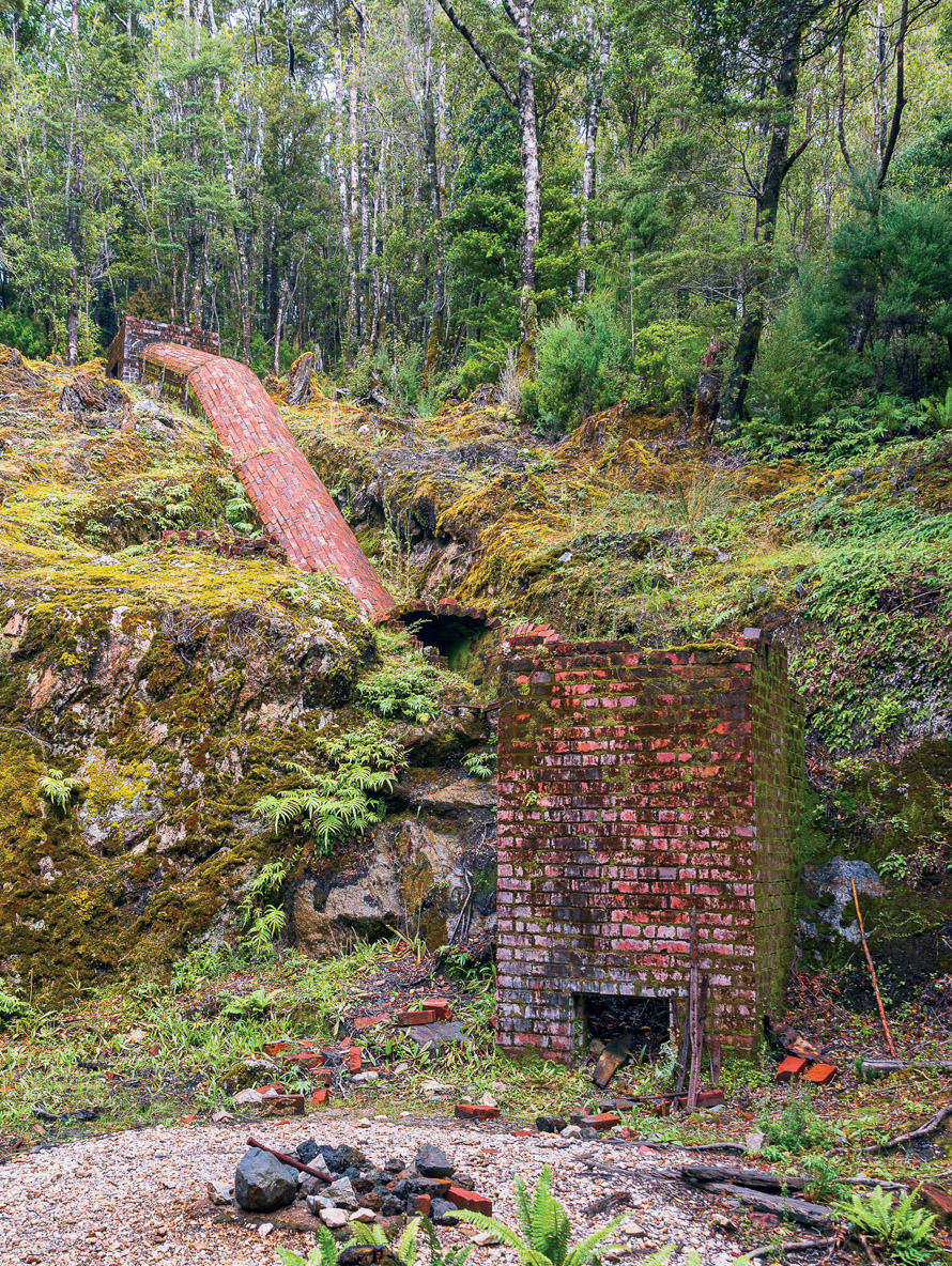
The rich history of Preservation Inlet is dominated by the era of seal and whale hunting, which began with the establishment of a whaling station in 1829. This was followed by the development of a coal mine in 1851 and the discovery of gold around 1868... There are still vestiges of this era in Preservation, such as the old smelter chimneys and the remains of the gold mining railways.
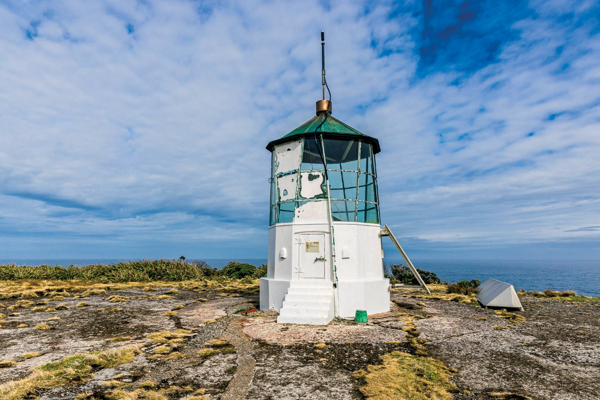
We anchored in Isthmus Cove, one of Preservation Inlet’s two highly protected anchorages, so that the next day we could hike to Puysegur Point lighthouse.
Stewart Island
The time had come to leave Fiordland and set sail again for Stewart Island at a latitude of 47° south. Stewart Island is New Zealand’s third island, between the Roaring Forties and the Furious Fifties. Its geographical location attracted explorers very early on. Captain Cook, who discovered this land on his first voyage in 1770, may or may not have believed it to be an island: he was mainly interested in discovering the southern tip of New Zealand and the weather conditions were not favorable for exploring Foveaux Strait that separates Stewart Island from South Island. We used the strait to reach the only town of any size, Oban, which had a lovely atmosphere and welcoming residents! In winter, however, the weather must be particularly harsh... The economy is essentially dependent upon tourism and fishing. Luke, a lobster fisherman whose cray pots are in Dusky, showed us which buoy to use, but the anchorage wasn’t very comfortable and we moved on to Golden Bay in Paterson Inlet, just to the south. This gave us a chance to visit Ulva Island, a bird sanctuary, where we encountered a Kàkà, a rare parrot that lives in the forests, and many Tui, New Zealand’s emblematic songbird.
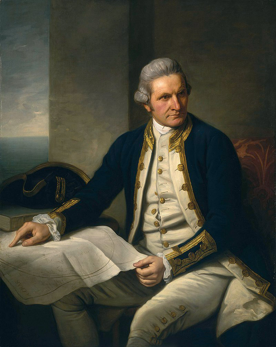
Remembering the Great Captains…
When reading about our adventures, you’ll notice that many places were named by explorer-navigators after geographical features or as a tribute to their illustrious contemporaries. Most of these navigators came from Australia and travelled along New Zealand’s southern coast to hunt whales and seals. That’s why the history of South Island is so much richer than that of the North. The English ships that transported convicts to New South Wales left with goods that they could then exchange in Canton, China, for tea, silk or spices that they would then take back to Europe, doing lucrative business. In the 1790s, there was a strong Chinese demand for seal pelts, a resource that Captain Cook had described as being abundant in the south of New Zealand...
Resources used when preparing the voyage
Books:
A Boaties’ Guide to Fiordland, Mana Cruising Club New Zealand
Stewart Island Cruising Guide, Mana Cruising Club New Zealand
Beneath the Reflections : A user’s guide to the Fiordland (Te Moana o Atawhenua) Marine Area, Fiordland Marine Guardians
Documentary Film:
Ata Whenua Fiordland, David Comer